Rothenthurm geodata
Rothenthurm (Schwyz) is a populated place; located in Switzerland in Europe/Zurich (GMT+2) time zone. With population of 2,098 people, there are 807 cities with bigger population in this country. Compared to other cities in Switzerland, 58.8% of cities are located further ↑North; 72.2% of cities are located further ←West and 93.2% of cities have lower elevation than Rothenthurm. Note1


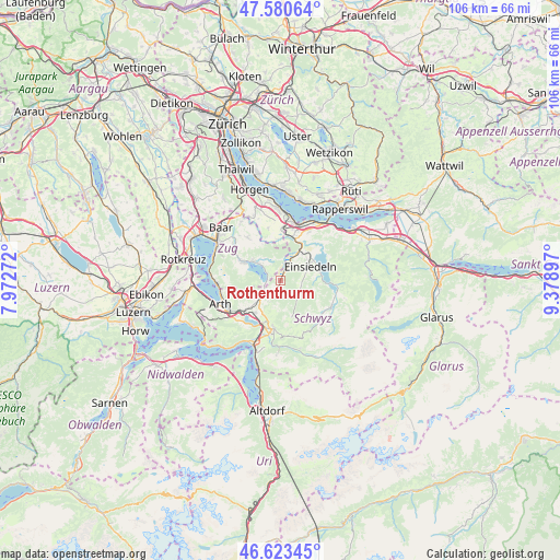
Rothenthurm GPS coordinates[2]
47° 6' 15.12" North, 8° 40' 33.06" East
| Map corner | latitude | longitude |
|---|---|---|
| Upper-left | 47.58064°, | 7.97272° |
| Center: | 47.1042°, | 8.67585° |
| Lower-right: | 46.62345°, | 9.37897° |
| Map W x H: | 106.4×106.4 km | = 66.1×66.1mi |
| max Lat: | 47.76737° ⇑58.8% North |
| Rothenthurm: | 47.1042° |
| min Lat: | ⇓41.2% South 45.83203° |
| min Long | Rothenthurm | max Long |
| 5.97153° | 8.67585° | 10.44624° |
| W 72.2%⇐ | ⇒27.8% E |
Elevation
Elevation of Rothenthurm is 928 m = 3045 ft, and this is 369.8 m = 1213 ft above average elevation for this country.
| Max E: |
1845 m = 6053 ft | 6.8% |
| Rothenthurm | 928 m 3045 ft | |
| Avg. | 558.2 m = 1831 ft | |
Min E: |
197 m = 646 ft | 93.2% |
See also: Switzerland elevation on elevation.city.
Geographical zone
Rothenthurm is located in North temperate zone (between Tropic of Cancer and the Arctic Circle). Distance of this North polar circle is 2163.7 km =1344.5 mi to North.| Distance of | km | miles | from Rothenthurm |
|---|---|---|---|
| North Pole | 4769.6 | 2963.7 | to North |
| Arctic Circle | 2163.7 | 1344.5 | to North |
| Tropic Cancer | 2631.6 | 1635.2 | to South |
| Equator | 5237.5 | 3254.4 | to South |


Nearby cities:
15 places around Rothenthurm: (largest is in red/bold)
• Alpthal
4.9 km =3 mi,  141°
141°
• Einsiedeln
6 km =3.7 mi,  63°
63°
• Feusisberg
10.7 km =6.6 mi,  30°
30°
• Ibach
10.6 km =6.6 mi,  192°
192°
• Lauerz
10.5 km =6.5 mi,  221°
221°
• Menzingen
10.3 km =6.4 mi,  322°
322°
• Oberiberg
10.7 km =6.6 mi,  133°
133°
• Samstagern
9.7 km =6 mi,  2°
2°
• Sattel
3.9 km =2.4 mi,  231°
231°
• Schindellegi
8.3 km =5.2 mi,  19°
19°
• Schwyz
9.4 km =5.8 mi, 190°
• Steinen
7.7 km =4.8 mi, 218°
• Steinerberg
8.8 km =5.5 mi, 231°
• Unterägeri
7.7 km =4.8 mi,  297°
297°
• Wollerau
10.6 km =6.6 mi, 17°
Sources, notices
• [Note1] Compared only with cities in Switzerland existing in our database
• [Src1] Map data: © OpenStreetMap contributors (CC-BY-SA)
• [Src2] Other city data from geonames.org with taken over terms of usage.
• [Src3] Geographical zone / Annual Mean Temperature by Robert A. Rohde @ Wikipedia
