Alpthal geodata
Alpthal (Schwyz) is a populated place; located in Switzerland in Europe/Zurich (GMT+2) time zone. With population of 559 people, there are 1734 cities with bigger population in this country. Compared to other cities in Switzerland, 60.4% of cities are located further ↑North; 75.6% of cities are located further ←West and 94.6% of cities have lower elevation than Alpthal. Note1


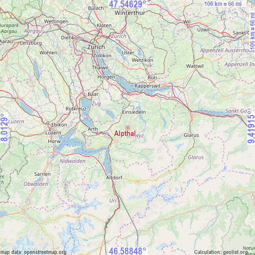
Alpthal GPS coordinates[2]
47° 4' 10.344" North, 8° 42' 57.672" East
| Map corner | latitude | longitude |
|---|---|---|
| Upper-left | 47.54629°, | 8.0129° |
| Center: | 47.06954°, | 8.71602° |
| Lower-right: | 46.58848°, | 9.41915° |
| Map W x H: | 106.5×106.5 km | = 66.2×66.2mi |
| max Lat: | 47.76737° ⇑60.4% North |
| Alpthal: | 47.06954° |
| min Lat: | ⇓39.6% South 45.83203° |
| min Long | Alpthal | max Long |
| 5.97153° | 8.71602° | 10.44624° |
| W 75.6%⇐ | ⇒24.4% E |
Elevation
Elevation of Alpthal is 998 m = 3274 ft, and this is 439.8 m = 1443 ft above average elevation for this country.
| Max E: |
1845 m = 6053 ft | 5.4% |
| Alpthal | 998 m 3274 ft | |
| Avg. | 558.2 m = 1831 ft | |
Min E: |
197 m = 646 ft | 94.6% |
See also: Switzerland elevation on elevation.city.
Geographical zone
Alpthal is located in North temperate zone (between Tropic of Cancer and the Arctic Circle). Distance of this North polar circle is 2167.5 km =1346.8 mi to North.| Distance of | km | miles | from Alpthal |
|---|---|---|---|
| North Pole | 4773.4 | 2966.1 | to North |
| Arctic Circle | 2167.5 | 1346.8 | to North |
| Tropic Cancer | 2627.7 | 1632.8 | to South |
| Equator | 5233.6 | 3252 | to South |


Nearby cities:
15 places around Alpthal: (largest is in red/bold)
• Einsiedeln
7 km =4.3 mi,  19°
19°
• Ibach
8.4 km =5.2 mi,  219°
219°
• Illgau
9.1 km =5.7 mi,  175°
175°
• Ingenbohl
11 km =6.8 mi, 224°
• Lauerz
10.8 km =6.7 mi,  248°
248°
• Morschach
12.2 km =7.6 mi, 217°
• Muotathal
11 km =6.8 mi,  160°
160°
• Oberiberg
5.9 km =3.7 mi,  125°
125°
• Rothenthurm
4.9 km =3 mi,  321°
321°
• Sattel
6.3 km =3.9 mi,  283°
283°
• Schindellegi
11.7 km =7.3 mi,  359°
359°
• Schwyz
7.2 km =4.5 mi, 220°
• Steinen
8.2 km =5.1 mi, 254°
• Steinerberg
10 km =6.2 mi,  260°
260°
• Unteriberg
6.8 km =4.2 mi,  96°
96°
Sources, notices
• [Note1] Compared only with cities in Switzerland existing in our database
• [Src1] Map data: © OpenStreetMap contributors (CC-BY-SA)
• [Src2] Other city data from geonames.org with taken over terms of usage.
• [Src3] Geographical zone / Annual Mean Temperature by Robert A. Rohde @ Wikipedia
