Siebnen geodata
Siebnen (Schwyz) is a populated place; located in Switzerland in Europe/Zurich (GMT+2) time zone. With population of 7,104 people, there are 227 cities with bigger population in this country. Compared to other cities in Switzerland, 54.8% of cities are located further ↑North; 84.5% of cities are located further ←West and 64.5% of cities have higher elevation than Siebnen. Note1


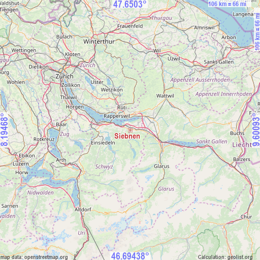
Siebnen GPS coordinates[2]
47° 10' 28.164" North, 8° 53' 52.116" East
| Map corner | latitude | longitude |
|---|---|---|
| Upper-left | 47.6503°, | 8.19468° |
| Center: | 47.17449°, | 8.89781° |
| Lower-right: | 46.69438°, | 9.60093° |
| Map W x H: | 106.3×106.3 km | = 66.1×66.1mi |
| max Lat: | 47.76737° ⇑54.8% North |
| Siebnen: | 47.17449° |
| min Lat: | ⇓45.2% South 45.83203° |
| min Long | Siebnen | max Long |
| 5.97153° | 8.89781° | 10.44624° |
| W 84.5%⇐ | ⇒15.5% E |
Elevation
Elevation of Siebnen is 447 m = 1467 ft, and this is 111.2 m = 365 ft below average elevation for this country.
| Max E: |
1845 m = 6053 ft | 64.5% |
| Avg. | 558.2 m = 1831 ft | |
| Siebnen | 447 m = 1467 ft | |
Min E: |
197 m = 646 ft | 35.5% |
See also: Switzerland elevation on elevation.city.
Geographical zone
Siebnen is located in North temperate zone (between Tropic of Cancer and the Arctic Circle). Distance of this North polar circle is 2155.9 km =1339.6 mi to North.| Distance of | km | miles | from Siebnen |
|---|---|---|---|
| North Pole | 4761.8 | 2958.8 | to North |
| Arctic Circle | 2155.9 | 1339.6 | to North |
| Tropic Cancer | 2639.4 | 1640 | to South |
| Equator | 5245.3 | 3259.3 | to South |


Nearby cities:
15 places around Siebnen: (largest is in red/bold)
• Altendorf
4.8 km =3 mi,  290°
290°
• Benken
8.7 km =5.4 mi,  71°
71°
• Eschenbach
7.5 km =4.7 mi,  13°
13°
• Jona
7.6 km =4.7 mi,  324°
324°
• Lachen
3.9 km =2.4 mi,  300°
300°
• Pfäffikon
9.5 km =5.9 mi, 288°
• Rapperswil
8.1 km =5 mi,  314°
314°
• Reichenburg
6 km =3.7 mi,  93°
93°
• Rüti / Dorfzentrum, Südl. Teil
9.3 km =5.8 mi,  340°
340°
• Sankt Gallenkappel
9.2 km =5.7 mi,  33°
33°
• Schmerikon
6.8 km =4.2 mi, 34°
• Schübelbach
2.3 km =1.4 mi, 93°
• Tuggen
5 km =3.1 mi,  50°
50°
• Uznach
8.5 km =5.3 mi, 49°
• Vorderthal
5.9 km =3.7 mi,  176°
176°
Sources, notices
• [Note1] Compared only with cities in Switzerland existing in our database
• [Src1] Map data: © OpenStreetMap contributors (CC-BY-SA)
• [Src2] Other city data from geonames.org with taken over terms of usage.
• [Src3] Geographical zone / Annual Mean Temperature by Robert A. Rohde @ Wikipedia
