Thayngen geodata
Thayngen (Schaffhausen) is a seat of a second-order administrative division; located in Switzerland in Europe/Zurich (GMT+2) time zone. With population of 4,120 people, there are 425 cities with bigger population in this country. Compared to other cities in Switzerland, 99.8% of cities are located further ↓South; 74.9% of cities are located further ←West and 72.4% of cities have higher elevation than Thayngen. Note1


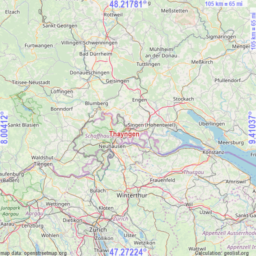
Thayngen GPS coordinates[2]
47° 44' 49.812" North, 8° 42' 26.064" East
| Map corner | latitude | longitude |
|---|---|---|
| Upper-left | 48.21781°, | 8.00412° |
| Center: | 47.74717°, | 8.70724° |
| Lower-right: | 47.27224°, | 9.41037° |
| Map W x H: | 105.1×105.1 km | = 65.3×65.3mi |
| max Lat: | 47.76737° ⇑0.2% North |
| Thayngen: | 47.74717° |
| min Lat: | ⇓99.8% South 45.83203° |
| min Long | Thayngen | max Long |
| 5.97153° | 8.70724° | 10.44624° |
| W 74.9%⇐ | ⇒25.1% E |
Elevation
Elevation of Thayngen is 436 m = 1430 ft, and this is 122.2 m = 401 ft below average elevation for this country.
| Max E: |
1845 m = 6053 ft | 72.4% |
| Avg. | 558.2 m = 1831 ft | |
| Thayngen | 436 m = 1430 ft | |
Min E: |
197 m = 646 ft | 27.6% |
See also: Switzerland elevation on elevation.city.
Geographical zone
Thayngen is located in North temperate zone (between Tropic of Cancer and the Arctic Circle). Distance of this North polar circle is 2092.2 km =1300 mi to North.| Distance of | km | miles | from Thayngen |
|---|---|---|---|
| North Pole | 4698.1 | 2919.3 | to North |
| Arctic Circle | 2092.2 | 1300 | to North |
| Tropic Cancer | 2703.1 | 1679.6 | to South |
| Equator | 5309 | 3298.9 | to South |


Nearby cities:
15 places around Thayngen: (largest is in red/bold)
• Benken
11.2 km =7 mi,  200°
200°
• Dachsen
11.3 km =7 mi,  216°
216°
• Diessenhofen
7.2 km =4.5 mi,  153°
153°
• Dörflingen
4.7 km =2.9 mi,  166°
166°
• Feuerthalen
7.9 km =4.9 mi, 217°
• Flurlingen
9.1 km =5.7 mi, 219°
• Hemmental
9.2 km =5.7 mi,  260°
260°
• Langwiesen
7.8 km =4.8 mi,  206°
206°
• Lohn
3 km =1.9 mi,  286°
286°
• Merishausen
7.4 km =4.6 mi,  281°
281°
• Neuhausen
9.7 km =6 mi,  225°
225°
• Ramsen
8.8 km =5.5 mi,  119°
119°
• Schaffhausen
7.7 km =4.8 mi, 224°
• Stetten
3.4 km =2.1 mi, 256°
• Uhwiesen
10.1 km =6.3 mi, 212°
Sources, notices
• [Note1] Compared only with cities in Switzerland existing in our database
• [Src1] Map data: © OpenStreetMap contributors (CC-BY-SA)
• [Src2] Other city data from geonames.org with taken over terms of usage.
• [Src3] Geographical zone / Annual Mean Temperature by Robert A. Rohde @ Wikipedia
