Ramsen geodata
Ramsen (Schaffhausen) is a populated place; located in Switzerland in Europe/Zurich (GMT+2) time zone. With population of 1,316 people, there are 1126 cities with bigger population in this country. Compared to other cities in Switzerland, 99.6% of cities are located further ↓South; 81.6% of cities are located further ←West and 82.9% of cities have higher elevation than Ramsen. Note1


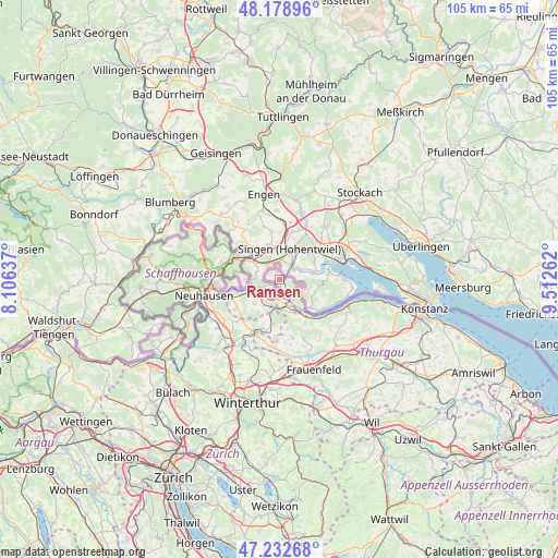
Ramsen GPS coordinates[2]
47° 42' 28.692" North, 8° 48' 34.164" East
| Map corner | latitude | longitude |
|---|---|---|
| Upper-left | 48.17896°, | 8.10637° |
| Center: | 47.70797°, | 8.80949° |
| Lower-right: | 47.23268°, | 9.51262° |
| Map W x H: | 105.2×105.2 km | = 65.4×65.4mi |
| max Lat: | 47.76737° ⇑0.4% North |
| Ramsen: | 47.70797° |
| min Lat: | ⇓99.6% South 45.83203° |
| min Long | Ramsen | max Long |
| 5.97153° | 8.80949° | 10.44624° |
| W 81.6%⇐ | ⇒18.4% E |
Elevation
Elevation of Ramsen is 415 m = 1362 ft, and this is 143.2 m = 470 ft below average elevation for this country.
| Max E: |
1845 m = 6053 ft | 82.9% |
| Avg. | 558.2 m = 1831 ft | |
| Ramsen | 415 m = 1362 ft | |
Min E: |
197 m = 646 ft | 17.1% |
See also: Switzerland elevation on elevation.city.
Geographical zone
Ramsen is located in North temperate zone (between Tropic of Cancer and the Arctic Circle). Distance of this North polar circle is 2096.5 km =1302.7 mi to North.| Distance of | km | miles | from Ramsen |
|---|---|---|---|
| North Pole | 4702.4 | 2921.9 | to North |
| Arctic Circle | 2096.5 | 1302.7 | to North |
| Tropic Cancer | 2698.7 | 1676.9 | to South |
| Equator | 5304.6 | 3296.1 | to South |


Nearby cities:
15 places around Ramsen: (largest is in red/bold)
• Diessenhofen
5 km =3.1 mi,  244°
244°
• Dörflingen
6.5 km =4 mi,  268°
268°
• Eschenz
8.3 km =5.2 mi,  143°
143°
• Hüttwilen
12.2 km =7.6 mi,  156°
156°
• Langwiesen
11.4 km =7.1 mi,  256°
256°
• Lohn
11.8 km =7.3 mi,  296°
296°
• Mammern
10.5 km =6.5 mi,  130°
130°
• Oberneuforn
11.9 km =7.4 mi,  195°
195°
• Oberstammheim
8.4 km =5.2 mi,  185°
185°
• Stein am Rhein
6.6 km =4.1 mi,  145°
145°
• Stetten
11.5 km =7.1 mi,  288°
288°
• Thayngen
8.8 km =5.5 mi, 299°
• Trüllikon
12.1 km =7.5 mi,  228°
228°
• Unterstammheim
7.8 km =4.8 mi, 190°
• Wagenhausen
6.1 km =3.8 mi, 151°
Sources, notices
• [Note1] Compared only with cities in Switzerland existing in our database
• [Src1] Map data: © OpenStreetMap contributors (CC-BY-SA)
• [Src2] Other city data from geonames.org with taken over terms of usage.
• [Src3] Geographical zone / Annual Mean Temperature by Robert A. Rohde @ Wikipedia
