Benken geodata
Benken (Saint Gallen) is a populated place; located in Switzerland in Europe/Zurich (GMT+2) time zone. With population of 2,419 people, there are 710 cities with bigger population in this country. Compared to other cities in Switzerland, 52.8% of cities are located further ↑North; 88.6% of cities are located further ←West and 71.5% of cities have higher elevation than Benken. Note1
Administrative division(s):
- Level 1: Saint Gallen
- Level 2: Wahlkreis See-Gaster
- Level 3: Benken (SG)


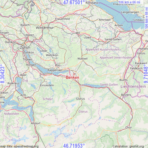
Benken GPS coordinates[2]
47° 11' 57.912" North, 9° 0' 26.46" East
| Map corner | latitude | longitude |
|---|---|---|
| Upper-left | 47.67501°, | 8.30423° |
| Center: | 47.19942°, | 9.00735° |
| Lower-right: | 46.71953°, | 9.71048° |
| Map W x H: | 106.2×106.2 km | = 66×66mi |
| max Lat: | 47.76737° ⇑52.8% North |
| Benken: | 47.19942° |
| min Lat: | ⇓47.2% South 45.83203° |
| min Long | Benken | max Long |
| 5.97153° | 9.00735° | 10.44624° |
| W 88.6%⇐ | ⇒11.4% E |
Elevation
Elevation of Benken is 437 m = 1434 ft, and this is 121.2 m = 398 ft below average elevation for this country.
| Max E: |
1845 m = 6053 ft | 71.5% |
| Avg. | 558.2 m = 1831 ft | |
| Benken | 437 m = 1434 ft | |
Min E: |
197 m = 646 ft | 28.5% |
See also: Switzerland elevation on elevation.city.
Geographical zone
Benken is located in North temperate zone (between Tropic of Cancer and the Arctic Circle). Distance of this North polar circle is 2153.1 km =1337.9 mi to North.| Distance of | km | miles | from Benken |
|---|---|---|---|
| North Pole | 4759 | 2957.1 | to North |
| Arctic Circle | 2153.1 | 1337.9 | to North |
| Tropic Cancer | 2642.2 | 1641.8 | to South |
| Equator | 5248.1 | 3261 | to South |


Nearby cities:
15 places around Benken: (largest is in red/bold)
• Bilten
5.7 km =3.5 mi,  165°
165°
• Eschenbach
7.9 km =4.9 mi,  304°
304°
• Goldingen
8 km =5 mi,  334°
334°
• Gommiswald
3.7 km =2.3 mi,  19°
19°
• Kaltbrunn
2.1 km =1.3 mi,  41°
41°
• Laupen
9.4 km =5.8 mi,  320°
320°
• Niederurnen
8.9 km =5.5 mi,  156°
156°
• Reichenburg
3.9 km =2.4 mi,  215°
215°
• Sankt Gallenkappel
5.9 km =3.7 mi, 326°
• Schmerikon
5.3 km =3.3 mi, 302°
• Schänis
5.3 km =3.3 mi,  146°
146°
• Schübelbach
6.7 km =4.2 mi,  244°
244°
• Siebnen
8.7 km =5.4 mi,  251°
251°
• Tuggen
4.4 km =2.7 mi,  275°
275°
• Uznach
3.3 km =2.1 mi, 325°
Sources, notices
• [Note1] Compared only with cities in Switzerland existing in our database
• [Src1] Map data: © OpenStreetMap contributors (CC-BY-SA)
• [Src2] Other city data from geonames.org with taken over terms of usage.
• [Src3] Geographical zone / Annual Mean Temperature by Robert A. Rohde @ Wikipedia
