Sankt Niklaus geodata
Sankt Niklaus (Valais) is a populated place; located in Switzerland in Europe/Zurich (GMT+2) time zone. With population of 2,352 people, there are 725 cities with bigger population in this country. Compared to other cities in Switzerland, 95.4% of cities are located further ↑North; 65.4% of cities are located further →East and 96.5% of cities have lower elevation than Sankt Niklaus. Note1


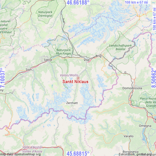
Sankt Niklaus GPS coordinates[2]
46° 10' 37.812" North, 7° 48' 12.564" East
| Map corner | latitude | longitude |
|---|---|---|
| Upper-left | 46.66188°, | 7.10037° |
| Center: | 46.17717°, | 7.80349° |
| Lower-right: | 45.68815°, | 8.50662° |
| Map W x H: | 108.3×108.3 km | = 67.3×67.3mi |
| max Lat: | 47.76737° ⇑95.4% North |
| Sankt Niklaus: | 46.17717° |
| min Lat: | ⇓4.6% South 45.83203° |
| min Long | Sankt Niklaus | max Long |
| 5.97153° | 7.80349° | 10.44624° |
| W 34.6%⇐ | ⇒65.4% E |
Elevation
Elevation of Sankt Niklaus is 1115 m = 3658 ft, and this is 556.8 m = 1827 ft above average elevation for this country.
| Max E: |
1845 m = 6053 ft | 3.5% |
| Sankt Niklaus | 1115 m 3658 ft | |
| Avg. | 558.2 m = 1831 ft | |
Min E: |
197 m = 646 ft | 96.5% |
See also: Switzerland elevation on elevation.city.
Geographical zone
Sankt Niklaus is located in North temperate zone (between Tropic of Cancer and the Arctic Circle). Distance of this North polar circle is 2266.8 km =1408.5 mi to North.| Distance of | km | miles | from Sankt Niklaus |
|---|---|---|---|
| North Pole | 4872.6 | 3027.7 | to North |
| Arctic Circle | 2266.8 | 1408.5 | to North |
| Tropic Cancer | 2528.5 | 1571.1 | to South |
| Equator | 5134.4 | 3190.4 | to South |


Nearby cities:
15 places around Sankt Niklaus: (largest is in red/bold)
• Baltschieder
15.4 km =9.6 mi,  18°
18°
• Bürchen
11.5 km =7.1 mi,  4°
4°
• Eischoll
13.1 km =8.1 mi,  352°
352°
• Grächen
3.3 km =2.1 mi,  52°
52°
• Lalden
15.6 km =9.7 mi,  29°
29°
• Niedergesteln
15.1 km =9.4 mi, 354°
• Raron
15 km =9.3 mi,  359°
359°
• Saas-Fee
12.3 km =7.6 mi,  128°
128°
• Saas-Grund
11.9 km =7.4 mi,  120°
120°
• Stalden
8.2 km =5.1 mi,  40°
40°
• Staldenried
8.4 km =5.2 mi, 46°
• Täsch
12.3 km =7.6 mi,  189°
189°
• Törbel
7.8 km =4.8 mi, 28°
• Visp
14.3 km =8.9 mi, 24°
• Visperterminen
11.8 km =7.3 mi, 39°
Sources, notices
• [Note1] Compared only with cities in Switzerland existing in our database
• [Src1] Map data: © OpenStreetMap contributors (CC-BY-SA)
• [Src2] Other city data from geonames.org with taken over terms of usage.
• [Src3] Geographical zone / Annual Mean Temperature by Robert A. Rohde @ Wikipedia
