Ottenbach geodata
Ottenbach (Zurich) is a populated place; located in Switzerland in Europe/Zurich (GMT+2) time zone. With population of 2,039 people, there are 823 cities with bigger population in this country. Compared to other cities in Switzerland, 56.1% of cities are located further ↓South; 50.1% of cities are located further →East and 82.8% of cities have higher elevation than Ottenbach. Note1


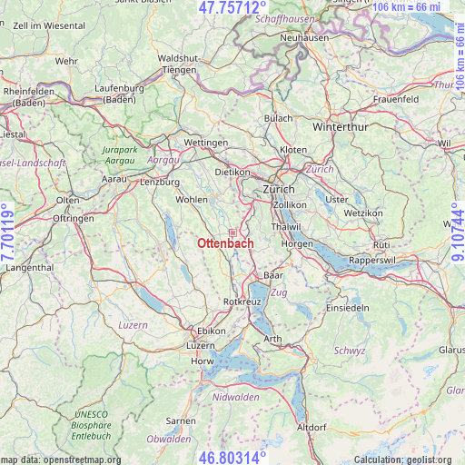
Ottenbach GPS coordinates[2]
47° 16' 56.208" North, 8° 24' 15.552" East
| Map corner | latitude | longitude |
|---|---|---|
| Upper-left | 47.75712°, | 7.70119° |
| Center: | 47.28228°, | 8.40432° |
| Lower-right: | 46.80314°, | 9.10744° |
| Map W x H: | 106.1×106.1 km | = 65.9×65.9mi |
| max Lat: | 47.76737° ⇑43.9% North |
| Ottenbach: | 47.28228° |
| min Lat: | ⇓56.1% South 45.83203° |
| min Long | Ottenbach | max Long |
| 5.97153° | 8.40432° | 10.44624° |
| W 49.9%⇐ | ⇒50.1% E |
Elevation
Elevation of Ottenbach is 416 m = 1365 ft, and this is 142.2 m = 467 ft below average elevation for this country.
| Max E: |
1845 m = 6053 ft | 82.8% |
| Avg. | 558.2 m = 1831 ft | |
| Ottenbach | 416 m = 1365 ft | |
Min E: |
197 m = 646 ft | 17.2% |
See also: Switzerland elevation on elevation.city.
Geographical zone
Ottenbach is located in North temperate zone (between Tropic of Cancer and the Arctic Circle). Distance of this North polar circle is 2143.9 km =1332.2 mi to North.| Distance of | km | miles | from Ottenbach |
|---|---|---|---|
| North Pole | 4749.8 | 2951.4 | to North |
| Arctic Circle | 2143.9 | 1332.2 | to North |
| Tropic Cancer | 2651.4 | 1647.5 | to South |
| Equator | 5257.3 | 3266.7 | to South |


Nearby cities:
15 places around Ottenbach: (largest is in red/bold)
• Affoltern / Goldiger Berg
3.1 km =1.9 mi,  97°
97°
• Affoltern / Hasenbüel
3.7 km =2.3 mi,  105°
105°
• Affoltern / Oberdorf
4 km =2.5 mi, 96°
• Affoltern / Unterdorf
3.8 km =2.4 mi,  89°
89°
• Affoltern am Albis
3.6 km =2.2 mi, 98°
• Aristau
3.1 km =1.9 mi,  279°
279°
• Hedingen
3.7 km =2.3 mi,  62°
62°
• Jonen
1.9 km =1.2 mi,  332°
332°
• Merenschwand
3.3 km =2.1 mi,  219°
219°
• Oberlunkhofen
3.5 km =2.2 mi,  345°
345°
• Obfelden
2.4 km =1.5 mi,  147°
147°
• Obfelden / Bickwil
2.1 km =1.3 mi,  133°
133°
• Obfelden / Oberlunnern
2.4 km =1.5 mi,  158°
158°
• Obfelden / Toussen
2.7 km =1.7 mi, 133°
• Zwillikon
2.1 km =1.3 mi,  71°
71°
Sources, notices
• [Note1] Compared only with cities in Switzerland existing in our database
• [Src1] Map data: © OpenStreetMap contributors (CC-BY-SA)
• [Src2] Other city data from geonames.org with taken over terms of usage.
• [Src3] Geographical zone / Annual Mean Temperature by Robert A. Rohde @ Wikipedia
