Merenschwand geodata
Merenschwand (Aargau) is a populated place; located in Switzerland in Europe/Zurich (GMT+2) time zone. With population of 2,479 people, there are 700 cities with bigger population in this country. Compared to other cities in Switzerland, 52.8% of cities are located further ↓South; 51.4% of cities are located further →East and 91.1% of cities have higher elevation than Merenschwand. Note1


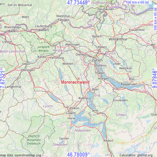
Merenschwand GPS coordinates[2]
47° 15' 33.984" North, 8° 22' 34.788" East
| Map corner | latitude | longitude |
|---|---|---|
| Upper-left | 47.73449°, | 7.67321° |
| Center: | 47.25944°, | 8.37633° |
| Lower-right: | 46.78009°, | 9.07946° |
| Map W x H: | 106.1×106.1 km | = 65.9×65.9mi |
| max Lat: | 47.76737° ⇑47.2% North |
| Merenschwand: | 47.25944° |
| min Lat: | ⇓52.8% South 45.83203° |
| min Long | Merenschwand | max Long |
| 5.97153° | 8.37633° | 10.44624° |
| W 48.6%⇐ | ⇒51.4% E |
Elevation
Elevation of Merenschwand is 389 m = 1276 ft, and this is 169.2 m = 555 ft below average elevation for this country.
| Max E: |
1845 m = 6053 ft | 91.1% |
| Avg. | 558.2 m = 1831 ft | |
| Merenschwand | 389 m = 1276 ft | |
Min E: |
197 m = 646 ft | 8.9% |
See also: Switzerland elevation on elevation.city.
Geographical zone
Merenschwand is located in North temperate zone (between Tropic of Cancer and the Arctic Circle). Distance of this North polar circle is 2146.4 km =1333.7 mi to North.| Distance of | km | miles | from Merenschwand |
|---|---|---|---|
| North Pole | 4752.3 | 2952.9 | to North |
| Arctic Circle | 2146.4 | 1333.7 | to North |
| Tropic Cancer | 2648.8 | 1645.9 | to South |
| Equator | 5254.8 | 3265.2 | to South |


Nearby cities:
15 places around Merenschwand: (largest is in red/bold)
• Affoltern / Goldiger Berg
5.6 km =3.5 mi,  67°
67°
• Affoltern / Hasenbüel
5.9 km =3.7 mi, 74°
• Aristau
3.2 km =2 mi,  342°
342°
• Auw
5.5 km =3.4 mi,  188°
188°
• Buttwil
5.1 km =3.2 mi,  281°
281°
• Jonen
4.4 km =2.7 mi,  16°
16°
• Muri
3.3 km =2.1 mi,  300°
300°
• Mühlau
3.5 km =2.2 mi,  164°
164°
• Oberlunkhofen
6 km =3.7 mi,  11°
11°
• Obfelden
3.4 km =2.1 mi,  81°
81°
• Obfelden / Bickwil
3.8 km =2.4 mi, 72°
• Obfelden / Oberlunnern
3 km =1.9 mi, 84°
• Obfelden / Toussen
4.1 km =2.5 mi, 80°
• Ottenbach
3.3 km =2.1 mi,  39°
39°
• Zwillikon
5.2 km =3.2 mi,  52°
52°
Sources, notices
• [Note1] Compared only with cities in Switzerland existing in our database
• [Src1] Map data: © OpenStreetMap contributors (CC-BY-SA)
• [Src2] Other city data from geonames.org with taken over terms of usage.
• [Src3] Geographical zone / Annual Mean Temperature by Robert A. Rohde @ Wikipedia
