Aristau geodata
Aristau (Aargau) is a populated place; located in Switzerland in Europe/Zurich (GMT+2) time zone. With population of 1,313 people, there are 1129 cities with bigger population in this country. Compared to other cities in Switzerland, 56.6% of cities are located further ↓South; 51.7% of cities are located further →East and 89.9% of cities have higher elevation than Aristau. Note1


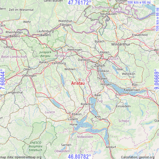
Aristau GPS coordinates[2]
47° 17' 12.912" North, 8° 21' 48.816" East
| Map corner | latitude | longitude |
|---|---|---|
| Upper-left | 47.76172°, | 7.66044° |
| Center: | 47.28692°, | 8.36356° |
| Lower-right: | 46.80782°, | 9.06669° |
| Map W x H: | 106.1×106.1 km | = 65.9×65.9mi |
| max Lat: | 47.76737° ⇑43.4% North |
| Aristau: | 47.28692° |
| min Lat: | ⇓56.6% South 45.83203° |
| min Long | Aristau | max Long |
| 5.97153° | 8.36356° | 10.44624° |
| W 48.3%⇐ | ⇒51.7% E |
Elevation
Elevation of Aristau is 395 m = 1296 ft, and this is 163.2 m = 535 ft below average elevation for this country.
| Max E: |
1845 m = 6053 ft | 89.9% |
| Avg. | 558.2 m = 1831 ft | |
| Aristau | 395 m = 1296 ft | |
Min E: |
197 m = 646 ft | 10.1% |
See also: Switzerland elevation on elevation.city.
Geographical zone
Aristau is located in North temperate zone (between Tropic of Cancer and the Arctic Circle). Distance of this North polar circle is 2143.4 km =1331.8 mi to North.| Distance of | km | miles | from Aristau |
|---|---|---|---|
| North Pole | 4749.2 | 2951 | to North |
| Arctic Circle | 2143.4 | 1331.8 | to North |
| Tropic Cancer | 2651.9 | 1647.8 | to South |
| Equator | 5257.8 | 3267 | to South |


Nearby cities:
15 places around Aristau: (largest is in red/bold)
• Besenbüren
3.3 km =2.1 mi,  336°
336°
• Buttwil
4.5 km =2.8 mi,  242°
242°
• Bünzen
3.9 km =2.4 mi,  310°
310°
• Jonen
2.5 km =1.6 mi,  61°
61°
• Merenschwand
3.2 km =2 mi,  162°
162°
• Muri
2.4 km =1.5 mi,  233°
233°
• Oberlunkhofen
3.6 km =2.2 mi,  37°
37°
• Obfelden
5.1 km =3.2 mi,  120°
120°
• Obfelden / Bickwil
5 km =3.1 mi,  112°
112°
• Obfelden / Oberlunnern
4.8 km =3 mi,  125°
125°
• Obfelden / Toussen
5.5 km =3.4 mi, 115°
• Ottenbach
3.1 km =1.9 mi,  99°
99°
• Rottenschwil
3 km =1.9 mi,  356°
356°
• Unterlunkhofen
4 km =2.5 mi,  19°
19°
• Zwillikon
5.1 km =3.2 mi,  88°
88°
Sources, notices
• [Note1] Compared only with cities in Switzerland existing in our database
• [Src1] Map data: © OpenStreetMap contributors (CC-BY-SA)
• [Src2] Other city data from geonames.org with taken over terms of usage.
• [Src3] Geographical zone / Annual Mean Temperature by Robert A. Rohde @ Wikipedia
