Haag (Rheintal) geodata
Haag (Rheintal) (Saint Gallen) is a populated place; located in Switzerland in Europe/Zurich (GMT+2) time zone. With population of 1,180 people, there are 1214 cities with bigger population in this country. Compared to other cities in Switzerland, 51.8% of cities are located further ↑North; 96.6% of cities are located further ←West and 67.9% of cities have higher elevation than Haag (Rheintal). Note1


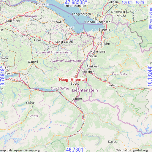
Haag (Rheintal) GPS coordinates[2]
47° 12' 35.604" North, 9° 29' 21.516" East
| Map corner | latitude | longitude |
|---|---|---|
| Upper-left | 47.68538°, | 8.78619° |
| Center: | 47.20989°, | 9.48931° |
| Lower-right: | 46.7301°, | 10.19244° |
| Map W x H: | 106.2×106.2 km | = 66×66mi |
| max Lat: | 47.76737° ⇑51.8% North |
| Haag (Rheintal): | 47.20989° |
| min Lat: | ⇓48.2% South 45.83203° |
| min Long | Haag (Rheintal) | max Long |
| 5.97153° | 9.48931° | 10.44624° |
| W 96.6%⇐ | ⇒3.4% E |
Elevation
Elevation of Haag (Rheintal) is 441 m = 1447 ft, and this is 117.2 m = 385 ft below average elevation for this country.
| Max E: |
1845 m = 6053 ft | 67.9% |
| Avg. | 558.2 m = 1831 ft | |
| Haag (Rheintal) | 441 m = 1447 ft | |
Min E: |
197 m = 646 ft | 32.1% |
See also: Switzerland elevation on elevation.city.
Geographical zone
Haag (Rheintal) is located in North temperate zone (between Tropic of Cancer and the Arctic Circle). Distance of this North polar circle is 2151.9 km =1337.1 mi to North.| Distance of | km | miles | from Haag (Rheintal) |
|---|---|---|---|
| North Pole | 4757.8 | 2956.4 | to North |
| Arctic Circle | 2151.9 | 1337.1 | to North |
| Tropic Cancer | 2643.3 | 1642.5 | to South |
| Equator | 5249.2 | 3261.7 | to South |


Nearby cities:
15 places around Haag (Rheintal): (largest is in red/bold)
• Appenzell
14.7 km =9.1 mi,  336°
336°
• Buchs
4.8 km =3 mi,  190°
190°
• Eichberg
15.2 km =9.4 mi,  12°
12°
• Flums
17.3 km =10.7 mi,  219°
219°
• Gais
17.1 km =10.6 mi,  350°
350°
• Gams
3.6 km =2.2 mi,  260°
260°
• Gonten
16.9 km =10.5 mi,  320°
320°
• Grabs
4.6 km =2.9 mi,  228°
228°
• Oberriet
13.7 km =8.5 mi,  25°
25°
• Rüthi
10.1 km =6.3 mi,  21°
21°
• Sennwald
5.7 km =3.5 mi, 10°
• Sevelen
9.8 km =6.1 mi,  181°
181°
• Unterwasser
13.7 km =8.5 mi, 264°
• Walenstadt
16.5 km =10.3 mi, 234°
• Wildhaus
10.2 km =6.3 mi,  267°
267°
Sources, notices
• [Note1] Compared only with cities in Switzerland existing in our database
• [Src1] Map data: © OpenStreetMap contributors (CC-BY-SA)
• [Src2] Other city data from geonames.org with taken over terms of usage.
• [Src3] Geographical zone / Annual Mean Temperature by Robert A. Rohde @ Wikipedia
