Sennwald geodata
Sennwald (Saint Gallen) is a populated place; located in Switzerland in Europe/Zurich (GMT+2) time zone. With population of 4,768 people, there are 362 cities with bigger population in this country. Compared to other cities in Switzerland, 53% of cities are located further ↓South; 96.7% of cities are located further ←West and 60.3% of cities have higher elevation than Sennwald. Note1


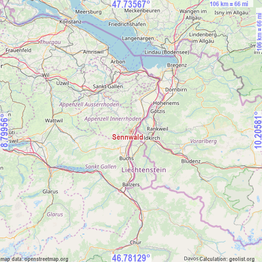
Sennwald GPS coordinates[2]
47° 15' 38.268" North, 9° 30' 9.648" East
| Map corner | latitude | longitude |
|---|---|---|
| Upper-left | 47.73567°, | 8.79956° |
| Center: | 47.26063°, | 9.50268° |
| Lower-right: | 46.78129°, | 10.20581° |
| Map W x H: | 106.1×106.1 km | = 65.9×65.9mi |
| max Lat: | 47.76737° ⇑47% North |
| Sennwald: | 47.26063° |
| min Lat: | ⇓53% South 45.83203° |
| min Long | Sennwald | max Long |
| 5.97153° | 9.50268° | 10.44624° |
| W 96.7%⇐ | ⇒3.3% E |
Elevation
Elevation of Sennwald is 454 m = 1490 ft, and this is 104.2 m = 342 ft below average elevation for this country.
| Max E: |
1845 m = 6053 ft | 60.3% |
| Avg. | 558.2 m = 1831 ft | |
| Sennwald | 454 m = 1490 ft | |
Min E: |
197 m = 646 ft | 39.7% |
See also: Switzerland elevation on elevation.city.
Geographical zone
Sennwald is located in North temperate zone (between Tropic of Cancer and the Arctic Circle). Distance of this North polar circle is 2146.3 km =1333.6 mi to North.| Distance of | km | miles | from Sennwald |
|---|---|---|---|
| North Pole | 4752.2 | 2952.9 | to North |
| Arctic Circle | 2146.3 | 1333.6 | to North |
| Tropic Cancer | 2649 | 1646 | to South |
| Equator | 5254.9 | 3265.2 | to South |


Nearby cities:
15 places around Sennwald: (largest is in red/bold)
• Altstätten
13.4 km =8.3 mi,  14°
14°
• Appenzell
10.5 km =6.5 mi,  318°
318°
• Buchs
10.5 km =6.5 mi,  190°
190°
• Bühler
13.8 km =8.6 mi,  335°
335°
• Eichberg
9.5 km =5.9 mi, 13°
• Gais
11.8 km =7.3 mi, 341°
• Gams
7.8 km =4.8 mi,  216°
216°
• Gonten
13.9 km =8.6 mi,  302°
302°
• Grabs
9.8 km =6.1 mi,  207°
207°
• Haag (Rheintal)
5.7 km =3.5 mi, 190°
• Haslen
15.8 km =9.8 mi, 319°
• Oberriet
8.3 km =5.2 mi,  36°
36°
• Rüthi
4.7 km =2.9 mi, 35°
• Sevelen
15.5 km =9.6 mi,  184°
184°
• Wildhaus
12.8 km =8 mi,  241°
241°
Sources, notices
• [Note1] Compared only with cities in Switzerland existing in our database
• [Src1] Map data: © OpenStreetMap contributors (CC-BY-SA)
• [Src2] Other city data from geonames.org with taken over terms of usage.
• [Src3] Geographical zone / Annual Mean Temperature by Robert A. Rohde @ Wikipedia
