Dietwil geodata
Dietwil (Aargau) is a populated place; located in Switzerland in Europe/Zurich (GMT+2) time zone. With population of 950 people, there are 1373 cities with bigger population in this country. Compared to other cities in Switzerland, 56.4% of cities are located further ↑North; 50.7% of cities are located further →East and 74.4% of cities have higher elevation than Dietwil. Note1


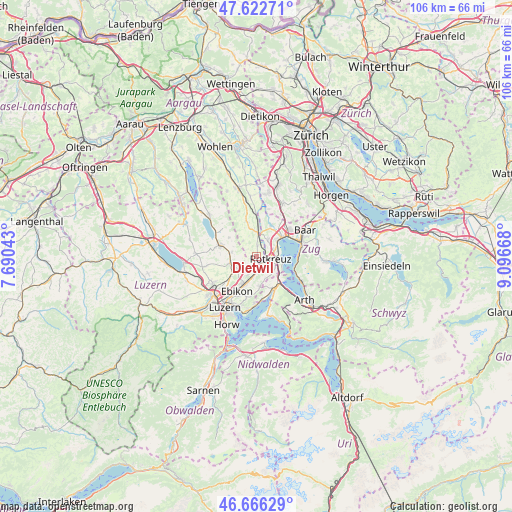
Dietwil GPS coordinates[2]
47° 8' 47.94" North, 8° 23' 36.78" East
| Map corner | latitude | longitude |
|---|---|---|
| Upper-left | 47.62271°, | 7.69043° |
| Center: | 47.14665°, | 8.39355° |
| Lower-right: | 46.66629°, | 9.09668° |
| Map W x H: | 106.3×106.3 km | = 66.1×66.1mi |
| max Lat: | 47.76737° ⇑56.4% North |
| Dietwil: | 47.14665° |
| min Lat: | ⇓43.6% South 45.83203° |
| min Long | Dietwil | max Long |
| 5.97153° | 8.39355° | 10.44624° |
| W 49.3%⇐ | ⇒50.7% E |
Elevation
Elevation of Dietwil is 432 m = 1417 ft, and this is 126.2 m = 414 ft below average elevation for this country.
| Max E: |
1845 m = 6053 ft | 74.4% |
| Avg. | 558.2 m = 1831 ft | |
| Dietwil | 432 m = 1417 ft | |
Min E: |
197 m = 646 ft | 25.6% |
See also: Switzerland elevation on elevation.city.
Geographical zone
Dietwil is located in North temperate zone (between Tropic of Cancer and the Arctic Circle). Distance of this North polar circle is 2159 km =1341.5 mi to North.| Distance of | km | miles | from Dietwil |
|---|---|---|---|
| North Pole | 4764.8 | 2960.7 | to North |
| Arctic Circle | 2159 | 1341.5 | to North |
| Tropic Cancer | 2636.3 | 1638.1 | to South |
| Equator | 5242.2 | 3257.4 | to South |


Nearby cities:
15 places around Dietwil: (largest is in red/bold)
• Auw
7.4 km =4.6 mi,  343°
343°
• Ballwil
5.4 km =3.4 mi,  278°
278°
• Buchrain
6.6 km =4.1 mi,  211°
211°
• Cham
6.6 km =4.1 mi,  53°
53°
• Hochdorf
8.1 km =5 mi,  287°
287°
• Hohenrain
6.9 km =4.3 mi,  303°
303°
• Hünenberg
4 km =2.5 mi,  36°
36°
• Inwil
4.1 km =2.5 mi,  234°
234°
• Küssnacht
7.7 km =4.8 mi,  151°
151°
• Meierskappel
4.4 km =2.7 mi,  123°
123°
• Oberrüti
2.2 km =1.4 mi,  1°
1°
• Root
3.6 km =2.2 mi,  184°
184°
• Rotkreuz
2.9 km =1.8 mi,  98°
98°
• Sins
5.1 km =3.2 mi, 0°
• Udligenswil
6.3 km =3.9 mi,  173°
173°
Sources, notices
• [Note1] Compared only with cities in Switzerland existing in our database
• [Src1] Map data: © OpenStreetMap contributors (CC-BY-SA)
• [Src2] Other city data from geonames.org with taken over terms of usage.
• [Src3] Geographical zone / Annual Mean Temperature by Robert A. Rohde @ Wikipedia
