Hünenberg geodata
Hünenberg (Zug) is a populated place; located in Switzerland in Europe/Zurich (GMT+2) time zone. With population of 9,032 people, there are 179 cities with bigger population in this country. Compared to other cities in Switzerland, 54.5% of cities are located further ↑North; 51.3% of cities are located further ←West and 63.1% of cities have higher elevation than Hünenberg. Note1


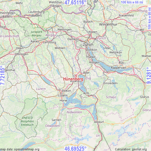
Hünenberg GPS coordinates[2]
47° 10' 31.296" North, 8° 25' 29.892" East
| Map corner | latitude | longitude |
|---|---|---|
| Upper-left | 47.65116°, | 7.72185° |
| Center: | 47.17536°, | 8.42497° |
| Lower-right: | 46.69525°, | 9.1281° |
| Map W x H: | 106.3×106.3 km | = 66.1×66.1mi |
| max Lat: | 47.76737° ⇑54.5% North |
| Hünenberg: | 47.17536° |
| min Lat: | ⇓45.5% South 45.83203° |
| min Long | Hünenberg | max Long |
| 5.97153° | 8.42497° | 10.44624° |
| W 51.3%⇐ | ⇒48.7% E |
Elevation
Elevation of Hünenberg is 449 m = 1473 ft, and this is 109.2 m = 358 ft below average elevation for this country.
| Max E: |
1845 m = 6053 ft | 63.1% |
| Avg. | 558.2 m = 1831 ft | |
| Hünenberg | 449 m = 1473 ft | |
Min E: |
197 m = 646 ft | 36.9% |
See also: Switzerland elevation on elevation.city.
Geographical zone
Hünenberg is located in North temperate zone (between Tropic of Cancer and the Arctic Circle). Distance of this North polar circle is 2155.8 km =1339.6 mi to North.| Distance of | km | miles | from Hünenberg |
|---|---|---|---|
| North Pole | 4761.7 | 2958.8 | to North |
| Arctic Circle | 2155.8 | 1339.6 | to North |
| Tropic Cancer | 2639.5 | 1640.1 | to South |
| Equator | 5245.4 | 3259.3 | to South |


Nearby cities:
15 places around Hünenberg: (largest is in red/bold)
• Auw
6 km =3.7 mi,  311°
311°
• Ballwil
8.1 km =5 mi,  252°
252°
• Cham
3 km =1.9 mi,  75°
75°
• Dietwil
4 km =2.5 mi,  216°
216°
• Hohenrain
8.1 km =5 mi,  274°
274°
• Inwil
8 km =5 mi,  225°
225°
• Knonau
6 km =3.7 mi,  27°
27°
• Meierskappel
5.8 km =3.6 mi,  166°
166°
• Mühlau
6.6 km =4.1 mi,  335°
335°
• Oberrüti
2.5 km =1.6 mi, 247°
• Root
7.3 km =4.5 mi,  201°
201°
• Rotkreuz
3.6 km =2.2 mi, 172°
• Sins
3.1 km =1.9 mi, 309°
• Steinhausen
5.1 km =3.2 mi,  64°
64°
• Zug
7 km =4.3 mi,  92°
92°
Sources, notices
• [Note1] Compared only with cities in Switzerland existing in our database
• [Src1] Map data: © OpenStreetMap contributors (CC-BY-SA)
• [Src2] Other city data from geonames.org with taken over terms of usage.
• [Src3] Geographical zone / Annual Mean Temperature by Robert A. Rohde @ Wikipedia
