Himmelried geodata
Himmelried (Solothurn) is a populated place; located in Switzerland in Europe/Zurich (GMT+2) time zone. With population of 1,002 people, there are 1325 cities with bigger population in this country. Compared to other cities in Switzerland, 77.8% of cities are located further ↓South; 71.7% of cities are located further →East and 80.8% of cities have lower elevation than Himmelried. Note1


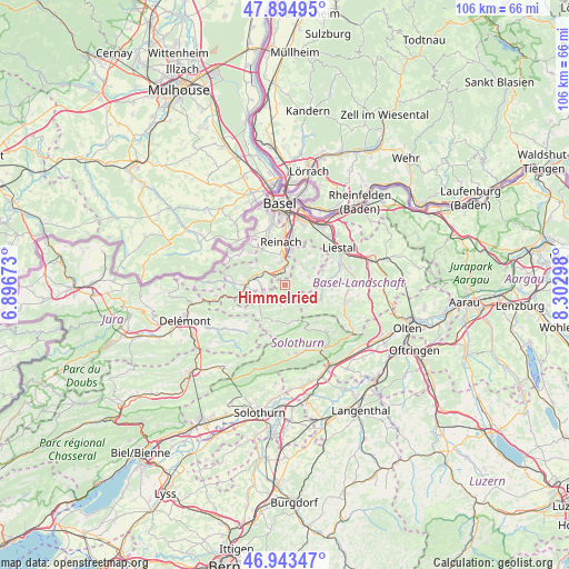
Himmelried GPS coordinates[2]
47° 25' 16.896" North, 7° 35' 59.46" East
| Map corner | latitude | longitude |
|---|---|---|
| Upper-left | 47.89495°, | 6.89673° |
| Center: | 47.42136°, | 7.59985° |
| Lower-right: | 46.94347°, | 8.30298° |
| Map W x H: | 105.8×105.8 km | = 65.7×65.7mi |
| max Lat: | 47.76737° ⇑22.2% North |
| Himmelried: | 47.42136° |
| min Lat: | ⇓77.8% South 45.83203° |
| min Long | Himmelried | max Long |
| 5.97153° | 7.59985° | 10.44624° |
| W 28.3%⇐ | ⇒71.7% E |
Elevation
Elevation of Himmelried is 668 m = 2192 ft, and this is 109.8 m = 360 ft above average elevation for this country.
| Max E: |
1845 m = 6053 ft | 19.2% |
| Himmelried | 668 m 2192 ft | |
| Avg. | 558.2 m = 1831 ft | |
Min E: |
197 m = 646 ft | 80.8% |
See also: Switzerland elevation on elevation.city.
Geographical zone
Himmelried is located in North temperate zone (between Tropic of Cancer and the Arctic Circle). Distance of this North polar circle is 2128.4 km =1322.5 mi to North.| Distance of | km | miles | from Himmelried |
|---|---|---|---|
| North Pole | 4734.3 | 2941.8 | to North |
| Arctic Circle | 2128.4 | 1322.5 | to North |
| Tropic Cancer | 2666.8 | 1657.1 | to South |
| Equator | 5272.8 | 3276.4 | to South |


Nearby cities:
15 places around Himmelried: (largest is in red/bold)
• Aesch
5.5 km =3.4 mi,  358°
358°
• Blauen
6.8 km =4.2 mi,  297°
297°
• Breitenbach
4.4 km =2.7 mi,  248°
248°
• Bretzwil
4.7 km =2.9 mi,  123°
123°
• Brislach
4.3 km =2.7 mi,  264°
264°
• Büsserach
5.4 km =3.4 mi,  235°
235°
• Dornach
6.7 km =4.2 mi,  10°
10°
• Erschwil
6.9 km =4.3 mi,  220°
220°
• Grellingen
2.5 km =1.6 mi,  340°
340°
• Hochwald
4.9 km =3 mi,  42°
42°
• Nunningen
3.4 km =2.1 mi,  153°
153°
• Pfeffingen
4.3 km =2.7 mi,  349°
349°
• Wahlen
6.7 km =4.2 mi, 251°
• Zullwil
3.4 km =2.1 mi,  179°
179°
• Zwingen
5.6 km =3.5 mi,  289°
289°
Sources, notices
• [Note1] Compared only with cities in Switzerland existing in our database
• [Src1] Map data: © OpenStreetMap contributors (CC-BY-SA)
• [Src2] Other city data from geonames.org with taken over terms of usage.
• [Src3] Geographical zone / Annual Mean Temperature by Robert A. Rohde @ Wikipedia
