Bretzwil geodata
Bretzwil (Basel-Landschaft) is a populated place; located in Switzerland in Europe/Zurich (GMT+2) time zone. With population of 746 people, there are 1543 cities with bigger population in this country. Compared to other cities in Switzerland, 73.4% of cities are located further ↓South; 69.9% of cities are located further →East and 77.1% of cities have lower elevation than Bretzwil. Note1


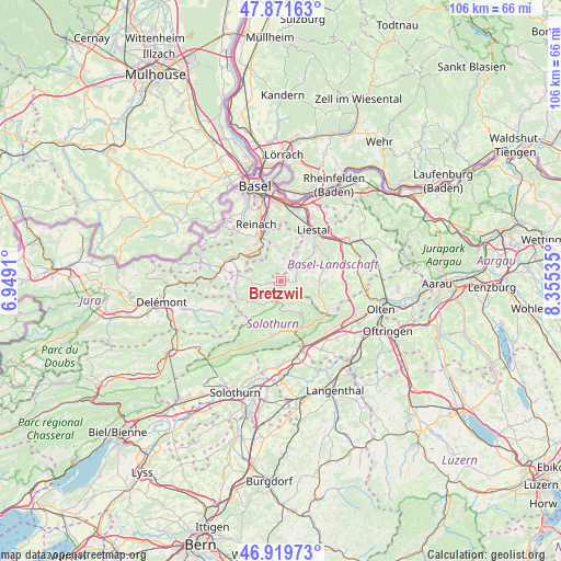
Bretzwil GPS coordinates[2]
47° 23' 52.188" North, 7° 39' 7.992" East
| Map corner | latitude | longitude |
|---|---|---|
| Upper-left | 47.87163°, | 6.9491° |
| Center: | 47.39783°, | 7.65222° |
| Lower-right: | 46.91973°, | 8.35535° |
| Map W x H: | 105.8×105.8 km | = 65.7×65.7mi |
| max Lat: | 47.76737° ⇑26.6% North |
| Bretzwil: | 47.39783° |
| min Lat: | ⇓73.4% South 45.83203° |
| min Long | Bretzwil | max Long |
| 5.97153° | 7.65222° | 10.44624° |
| W 30.1%⇐ | ⇒69.9% E |
Elevation
Elevation of Bretzwil is 635 m = 2083 ft, and this is 76.8 m = 252 ft above average elevation for this country.
| Max E: |
1845 m = 6053 ft | 22.9% |
| Bretzwil | 635 m 2083 ft | |
| Avg. | 558.2 m = 1831 ft | |
Min E: |
197 m = 646 ft | 77.1% |
See also: Switzerland elevation on elevation.city.
Geographical zone
Bretzwil is located in North temperate zone (between Tropic of Cancer and the Arctic Circle). Distance of this North polar circle is 2131 km =1324.1 mi to North.| Distance of | km | miles | from Bretzwil |
|---|---|---|---|
| North Pole | 4736.9 | 2943.4 | to North |
| Arctic Circle | 2131 | 1324.1 | to North |
| Tropic Cancer | 2664.2 | 1655.5 | to South |
| Equator | 5270.1 | 3274.7 | to South |


Nearby cities:
15 places around Bretzwil: (largest is in red/bold)
• Arboldswil
5.2 km =3.2 mi,  69°
69°
• Breitenbach
8.1 km =5 mi,  276°
276°
• Brislach
8.5 km =5.3 mi,  285°
285°
• Bubendorf
8.4 km =5.2 mi,  50°
50°
• Büsserach
8.4 km =5.2 mi,  267°
267°
• Gempen
8.7 km =5.4 mi,  3°
3°
• Grellingen
6.9 km =4.3 mi,  316°
316°
• Himmelried
4.7 km =2.9 mi,  303°
303°
• Hochwald
6.3 km =3.9 mi,  354°
354°
• Nunningen
2.5 km =1.6 mi,  260°
260°
• Oberdorf
7.5 km =4.7 mi,  93°
93°
• Pfeffingen
8.3 km =5.2 mi,  325°
325°
• Reigoldswil
2.6 km =1.6 mi, 89°
• Waldenburg
7.5 km =4.7 mi,  102°
102°
• Zullwil
4 km =2.5 mi, 259°
Sources, notices
• [Note1] Compared only with cities in Switzerland existing in our database
• [Src1] Map data: © OpenStreetMap contributors (CC-BY-SA)
• [Src2] Other city data from geonames.org with taken over terms of usage.
• [Src3] Geographical zone / Annual Mean Temperature by Robert A. Rohde @ Wikipedia
