Wahlen geodata
Wahlen (Basel-Landschaft) is a populated place; located in Switzerland in Europe/Zurich (GMT+2) time zone. With population of 1,383 people, there are 1096 cities with bigger population in this country. Compared to other cities in Switzerland, 74.2% of cities are located further ↓South; 75% of cities are located further →East and 87.1% of cities have higher elevation than Wahlen. Note1


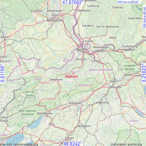
Wahlen GPS coordinates[2]
47° 24' 8.136" North, 7° 30' 54.396" East
| Map corner | latitude | longitude |
|---|---|---|
| Upper-left | 47.87602°, | 6.81198° |
| Center: | 47.40226°, | 7.51511° |
| Lower-right: | 46.9242°, | 8.21823° |
| Map W x H: | 105.8×105.8 km | = 65.7×65.7mi |
| max Lat: | 47.76737° ⇑25.8% North |
| Wahlen: | 47.40226° |
| min Lat: | ⇓74.2% South 45.83203° |
| min Long | Wahlen | max Long |
| 5.97153° | 7.51511° | 10.44624° |
| W 25%⇐ | ⇒75% E |
Elevation
Elevation of Wahlen is 404 m = 1325 ft, and this is 154.2 m = 506 ft below average elevation for this country.
| Max E: |
1845 m = 6053 ft | 87.1% |
| Avg. | 558.2 m = 1831 ft | |
| Wahlen | 404 m = 1325 ft | |
Min E: |
197 m = 646 ft | 12.9% |
See also: Switzerland elevation on elevation.city.
Geographical zone
Wahlen is located in North temperate zone (between Tropic of Cancer and the Arctic Circle). Distance of this North polar circle is 2130.5 km =1323.8 mi to North.| Distance of | km | miles | from Wahlen |
|---|---|---|---|
| North Pole | 4736.4 | 2943.1 | to North |
| Arctic Circle | 2130.5 | 1323.8 | to North |
| Tropic Cancer | 2664.7 | 1655.8 | to South |
| Equator | 5270.6 | 3275 | to South |


Nearby cities:
15 places around Wahlen: (largest is in red/bold)
• Blauen
5.3 km =3.3 mi,  3°
3°
• Breitenbach
2.3 km =1.4 mi,  77°
77°
• Brislach
2.7 km =1.7 mi,  51°
51°
• Bärschwil
3.9 km =2.4 mi,  235°
235°
• Büsserach
2.2 km =1.4 mi,  114°
114°
• Erschwil
3.7 km =2.3 mi,  147°
147°
• Grellingen
7.1 km =4.4 mi, 51°
• Himmelried
6.7 km =4.2 mi,  71°
71°
• Laufen
2.5 km =1.6 mi,  331°
331°
• Liesberg
6.6 km =4.1 mi,  271°
271°
• Mervelier
6.6 km =4.1 mi,  189°
189°
• Nunningen
7.9 km =4.9 mi,  96°
96°
• Röschenz
3.5 km =2.2 mi,  312°
312°
• Zullwil
6.5 km =4 mi, 100°
• Zwingen
4.2 km =2.6 mi,  15°
15°
Sources, notices
• [Note1] Compared only with cities in Switzerland existing in our database
• [Src1] Map data: © OpenStreetMap contributors (CC-BY-SA)
• [Src2] Other city data from geonames.org with taken over terms of usage.
• [Src3] Geographical zone / Annual Mean Temperature by Robert A. Rohde @ Wikipedia
