Erlenbach / links des Dorfbachs unterhalb Bahnlinie geodata
Erlenbach / links des Dorfbachs unterhalb Bahnlinie (Zurich) is a section of populated place; located in Switzerland in Europe/Zurich (GMT+1) time zone. With population of 729 people, there are 1561 cities with bigger population in this country. Compared to other cities in Switzerland, 58.1% of cities are located further ↓South; 66% of cities are located further ←West and 82.8% of cities have higher elevation than Erlenbach / links des Dorfbachs unterhalb Bahnlinie. Note1
Current local time in Erlenbach / links des Dorfbachs unterhalb Bahnlinie:
04:27 PM, SundayDifference from your time zone: hours


Erlenbach / links des Dorfbachs unterhalb Bahnlinie GPS coordinates[2]
47° 18' 1.872" North, 8° 35' 41.604" East
| Map corner | latitude | longitude |
|---|---|---|
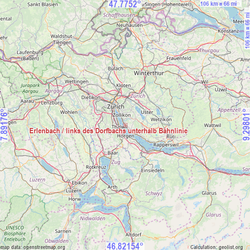
| Upper-left | 47.7752°, | 7.89176° |
| Center: | 47.30052°, | 8.59489° |
| Lower-right: | 46.82154°, | 9.29801° |
| Map W x H: | 106×106 km | = 65.9×65.9mi |
| max Lat: | 47.76737° ⇑41.9% North |
| Erlenbach / links des Dorfbachs unterhalb Bahnlinie: | 47.30052° |
| min Lat: | ⇓58.1% South 45.83203° |
| min Long | Erlenbach / lin | max Long |
| 5.97153° | 8.59489° | 10.44624° |
| W 66%⇐ | ⇒34% E |
Elevation
Elevation of Erlenbach / links des Dorfbachs unterhalb Bahnlinie is 416 m = 1365 ft, and this is 142.2 m = 467 ft below average elevation for this country.
| Max E: |
1845 m = 6053 ft | 82.8% |
| Avg. | 558.2 m = 1831 ft | |
| Erlenbach / links des Dorfbachs unterhalb Bahnlinie | 416 m = 1365 ft | |
Min E: |
197 m = 646 ft | 17.2% |
See also: Switzerland elevation on elevation.city.
Geographical zone
Erlenbach / links des Dorfbachs unterhalb Bahnlinie is located in North temperate zone (between Tropic of Cancer and the Arctic Circle). Distance of this North polar circle is 2141.8 km =1330.9 mi to North.| Distance of | km | miles | from Erlenbach / links des Dorfbachs unterhalb Bahnlinie |
|---|---|---|---|
| North Pole | 4747.7 | 2950.1 | to North |
| Arctic Circle | 2141.8 | 1330.9 | to North |
| Tropic Cancer | 2653.4 | 1648.7 | to South |
| Equator | 5259.3 | 3268 | to South |


Nearby cities:
15 places around Erlenbach / links des Dorfbachs unterhalb Bahnlinie: (largest is in red/bold)
• Erlenbach
0.3 km =0.2 mi,  34°
34°
• Erlenbach / links des Dorfbachs oberhalb Bahnlinie
0.5 km =0.3 mi,  102°
102°
• Erlenbach / rechts des Dorfbachs oberhalb Bahnlinie
0.9 km =0.6 mi,  41°
41°
• Erlenbach / rechts des Dorfbachs unterhalb Bahnlinie
0.6 km =0.4 mi,  326°
326°
• Herrliberg
1.9 km =1.2 mi,  126°
126°
• Küsnacht
2.1 km =1.3 mi,  337°
337°
• Küsnacht / Allmend
1.6 km =1 mi,  6°
6°
• Küsnacht / Dorf
2.1 km =1.3 mi, 335°
• Küsnacht / Heslibach
1.5 km =0.9 mi, 340°
• Küsnacht / Schiedhalden
2.3 km =1.4 mi,  348°
348°
• Thalwil
2.6 km =1.6 mi,  247°
247°
• Thalwil / Dorfkern
2.4 km =1.5 mi,  242°
242°
• Thalwil / Nord
2.9 km =1.8 mi,  263°
263°
• Thalwil / See
2.1 km =1.3 mi, 249°
• Thalwil / Süd
2.6 km =1.6 mi,  227°
227°
Sources, notices
• [Note1] Compared only with cities in Switzerland existing in our database
• [Src1] Map data: © OpenStreetMap contributors (CC-BY-SA)
• [Src2] Other city data from geonames.org with taken over terms of usage.
• [Src3] Geographical zone / Annual Mean Temperature by Robert A. Rohde @ Wikipedia
