Erlenbach / rechts des Dorfbachs unterhalb Bahnlinie geodata
Erlenbach / rechts des Dorfbachs unterhalb Bahnlinie (Zurich) is a section of populated place; located in Switzerland in Europe/Zurich (GMT+2) time zone. With population of 611 people, there are 1683 cities with bigger population in this country. Compared to other cities in Switzerland, 58.8% of cities are located further ↓South; 65.4% of cities are located further ←West and 83.8% of cities have higher elevation than Erlenbach / rechts des Dorfbachs unterhalb Bahnlinie. Note1
Current local time in Erlenbach / rechts des Dorfbachs unterhalb Bahnlinie:
07:35 AM, SaturdayDifference from your time zone: hours


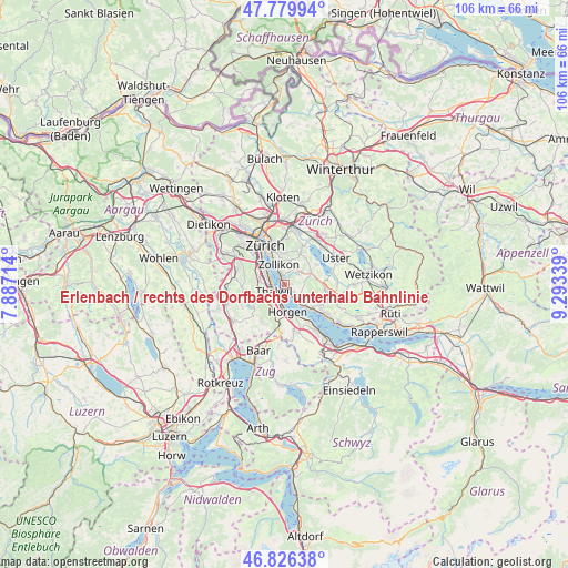
Erlenbach / rechts des Dorfbachs unterhalb Bahnlinie GPS coordinates[2]
47° 18' 19.116" North, 8° 35' 24.936" East
| Map corner | latitude | longitude |
|---|---|---|
| Upper-left | 47.77994°, | 7.88714° |
| Center: | 47.30531°, | 8.59026° |
| Lower-right: | 46.82638°, | 9.29339° |
| Map W x H: | 106×106 km | = 65.9×65.9mi |
| max Lat: | 47.76737° ⇑41.2% North |
| Erlenbach / rechts des Dorfbachs unterhalb Bahnlinie: | 47.30531° |
| min Lat: | ⇓58.8% South 45.83203° |
| min Long | Erlenbach / rec | max Long |
| 5.97153° | 8.59026° | 10.44624° |
| W 65.4%⇐ | ⇒34.6% E |
Elevation
Elevation of Erlenbach / rechts des Dorfbachs unterhalb Bahnlinie is 413 m = 1355 ft, and this is 145.2 m = 476 ft below average elevation for this country.
| Max E: |
1845 m = 6053 ft | 83.8% |
| Avg. | 558.2 m = 1831 ft | |
| Erlenbach / rechts des Dorfbachs unterhalb Bahnlinie | 413 m = 1355 ft | |
Min E: |
197 m = 646 ft | 16.2% |
See also: Switzerland elevation on elevation.city.
Geographical zone
Erlenbach / rechts des Dorfbachs unterhalb Bahnlinie is located in North temperate zone (between Tropic of Cancer and the Arctic Circle). Distance of this North polar circle is 2141.3 km =1330.5 mi to North.| Distance of | km | miles | from Erlenbach / rechts des Dorfbachs unterhalb Bahnlinie |
|---|---|---|---|
| North Pole | 4747.2 | 2949.8 | to North |
| Arctic Circle | 2141.3 | 1330.5 | to North |
| Tropic Cancer | 2653.9 | 1649.1 | to South |
| Equator | 5259.9 | 3268.3 | to South |


Nearby cities:
15 places around Erlenbach / rechts des Dorfbachs unterhalb Bahnlinie: (largest is in red/bold)
• Erlenbach
0.6 km =0.4 mi,  115°
115°
• Erlenbach / links des Dorfbachs oberhalb Bahnlinie
1.1 km =0.7 mi,  126°
126°
• Erlenbach / links des Dorfbachs unterhalb Bahnlinie
0.6 km =0.4 mi,  146°
146°
• Erlenbach / rechts des Dorfbachs oberhalb Bahnlinie
0.9 km =0.6 mi,  81°
81°
• Herrliberg
2.5 km =1.6 mi, 131°
• Küsnacht
1.5 km =0.9 mi,  341°
341°
• Küsnacht / Allmend
1.2 km =0.7 mi,  26°
26°
• Küsnacht / Dorf
1.5 km =0.9 mi, 338°
• Küsnacht / Goldbach
2.5 km =1.6 mi, 343°
• Küsnacht / Heslibach
0.9 km =0.6 mi,  351°
351°
• Küsnacht / Itschnach
2.6 km =1.6 mi,  17°
17°
• Küsnacht / Schiedhalden
1.8 km =1.1 mi,  356°
356°
• Thalwil
2.5 km =1.6 mi,  233°
233°
• Thalwil / Dorfkern
2.4 km =1.5 mi, 227°
• Thalwil / See
2 km =1.2 mi, 231°
Sources, notices
• [Note1] Compared only with cities in Switzerland existing in our database
• [Src1] Map data: © OpenStreetMap contributors (CC-BY-SA)
• [Src2] Other city data from geonames.org with taken over terms of usage.
• [Src3] Geographical zone / Annual Mean Temperature by Robert A. Rohde @ Wikipedia
