Goumoens-la-Ville geodata
Goumoens-la-Ville (Vaud) is a populated place; located in Switzerland in Europe/Zurich (GMT+2) time zone. With population of 609 people, there are 1685 cities with bigger population in this country. Compared to other cities in Switzerland, 80.1% of cities are located further ↑North; 94.2% of cities are located further →East and 75.1% of cities have lower elevation than Goumoens-la-Ville. Note1


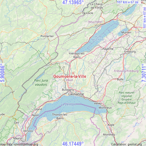
Goumoens-la-Ville GPS coordinates[2]
46° 39' 33.192" North, 6° 36' 14.328" East
| Map corner | latitude | longitude |
|---|---|---|
| Upper-left | 47.13965°, | 5.90086° |
| Center: | 46.65922°, | 6.60398° |
| Lower-right: | 46.17449°, | 7.30711° |
| Map W x H: | 107.3×107.3 km | = 66.7×66.7mi |
| max Lat: | 47.76737° ⇑80.1% North |
| Goumoens-la-Ville: | 46.65922° |
| min Lat: | ⇓19.9% South 45.83203° |
| min Long | Goumoens-la-Vil | max Long |
| 5.97153° | 6.60398° | 10.44624° |
| W 5.8%⇐ | ⇒94.2% E |
Elevation
Elevation of Goumoens-la-Ville is 618 m = 2028 ft, and this is 59.8 m = 196 ft above average elevation for this country.
| Max E: |
1845 m = 6053 ft | 24.9% |
| Goumoens-la-Ville | 618 m 2028 ft | |
| Avg. | 558.2 m = 1831 ft | |
Min E: |
197 m = 646 ft | 75.1% |
See also: Switzerland elevation on elevation.city.
Geographical zone
Goumoens-la-Ville is located in North temperate zone (between Tropic of Cancer and the Arctic Circle). Distance of this North polar circle is 2213.2 km =1375.2 mi to North.| Distance of | km | miles | from Goumoens-la-Ville |
|---|---|---|---|
| North Pole | 4819 | 2994.4 | to North |
| Arctic Circle | 2213.2 | 1375.2 | to North |
| Tropic Cancer | 2582.1 | 1604.4 | to South |
| Equator | 5188 | 3223.7 | to South |


Nearby cities:
15 places around Goumoens-la-Ville: (largest is in red/bold)
• Assens
5.3 km =3.3 mi,  165°
165°
• Bavois
3.9 km =2.4 mi,  314°
314°
• Bottens
6.5 km =4 mi,  137°
137°
• Chavornay
5.5 km =3.4 mi,  331°
331°
• Cheseaux
8.1 km =5 mi,  178°
178°
• Daillens
6 km =3.7 mi,  224°
224°
• Echallens
3 km =1.9 mi,  131°
131°
• La Sarraz
7.1 km =4.4 mi,  269°
269°
• Orny
6 km =3.7 mi,  278°
278°
• Pailly
7.2 km =4.5 mi,  49°
49°
• Penthalaz
8.1 km =5 mi,  228°
228°
• Penthéréaz
2.5 km =1.6 mi,  359°
359°
• Pompaples
7.2 km =4.5 mi, 276°
• Rueyres
7.7 km =4.8 mi,  60°
60°
• Vuarrens
4.5 km =2.8 mi, 48°
Sources, notices
• [Note1] Compared only with cities in Switzerland existing in our database
• [Src1] Map data: © OpenStreetMap contributors (CC-BY-SA)
• [Src2] Other city data from geonames.org with taken over terms of usage.
• [Src3] Geographical zone / Annual Mean Temperature by Robert A. Rohde @ Wikipedia
