Gommiswald geodata
Gommiswald (Saint Gallen) is a populated place; located in Switzerland in Europe/Zurich (GMT+2) time zone. With population of 2,781 people, there are 635 cities with bigger population in this country. Compared to other cities in Switzerland, 50.2% of cities are located further ↑North; 89% of cities are located further ←West and 72.3% of cities have lower elevation than Gommiswald. Note1


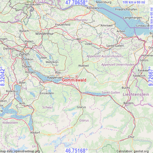
Gommiswald GPS coordinates[2]
47° 13' 52.608" North, 9° 1' 24.78" East
| Map corner | latitude | longitude |
|---|---|---|
| Upper-left | 47.70658°, | 8.32042° |
| Center: | 47.23128°, | 9.02355° |
| Lower-right: | 46.75168°, | 9.72667° |
| Map W x H: | 106.2×106.2 km | = 66×66mi |
| max Lat: | 47.76737° ⇑50.2% North |
| Gommiswald: | 47.23128° |
| min Lat: | ⇓49.8% South 45.83203° |
| min Long | Gommiswald | max Long |
| 5.97153° | 9.02355° | 10.44624° |
| W 89%⇐ | ⇒11% E |
Elevation
Elevation of Gommiswald is 590 m = 1936 ft, and this is 31.8 m = 104 ft above average elevation for this country.
| Max E: |
1845 m = 6053 ft | 27.7% |
| Gommiswald | 590 m 1936 ft | |
| Avg. | 558.2 m = 1831 ft | |
Min E: |
197 m = 646 ft | 72.3% |
See also: Switzerland elevation on elevation.city.
Geographical zone
Gommiswald is located in North temperate zone (between Tropic of Cancer and the Arctic Circle). Distance of this North polar circle is 2149.5 km =1335.6 mi to North.| Distance of | km | miles | from Gommiswald |
|---|---|---|---|
| North Pole | 4755.4 | 2954.9 | to North |
| Arctic Circle | 2149.5 | 1335.6 | to North |
| Tropic Cancer | 2645.7 | 1644 | to South |
| Equator | 5251.6 | 3263.2 | to South |


Nearby cities:
15 places around Gommiswald: (largest is in red/bold)
• Benken
3.7 km =2.3 mi,  199°
199°
• Bilten
9 km =5.6 mi,  179°
179°
• Ebnat-Kappel
8.4 km =5.2 mi,  65°
65°
• Eschenbach
7.8 km =4.8 mi,  277°
277°
• Goldingen
6 km =3.7 mi,  308°
308°
• Kaltbrunn
2 km =1.2 mi,  174°
174°
• Laupen
8.1 km =5 mi,  297°
297°
• Reichenburg
7.6 km =4.7 mi,  207°
207°
• Sankt Gallenkappel
4.7 km =2.9 mi,  287°
287°
• Schmerikon
5.7 km =3.5 mi,  263°
263°
• Schänis
8.1 km =5 mi, 168°
• Tuggen
6.5 km =4 mi,  240°
240°
• Uznach
3.2 km =2 mi, 255°
• Wald
9.6 km =6 mi, 301°
• Wattwil
9 km =5.6 mi,  32°
32°
Sources, notices
• [Note1] Compared only with cities in Switzerland existing in our database
• [Src1] Map data: © OpenStreetMap contributors (CC-BY-SA)
• [Src2] Other city data from geonames.org with taken over terms of usage.
• [Src3] Geographical zone / Annual Mean Temperature by Robert A. Rohde @ Wikipedia
