Hüttwilen geodata
Hüttwilen (Thurgau) is a populated place; located in Switzerland in Europe/Zurich (GMT+2) time zone. With population of 1,381 people, there are 1097 cities with bigger population in this country. Compared to other cities in Switzerland, 97.5% of cities are located further ↓South; 84.2% of cities are located further ←West and 56% of cities have higher elevation than Hüttwilen. Note1


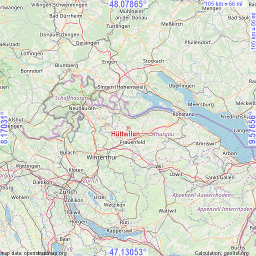
Hüttwilen GPS coordinates[2]
47° 36' 24.264" North, 8° 52' 24.348" East
| Map corner | latitude | longitude |
|---|---|---|
| Upper-left | 48.07865°, | 8.17031° |
| Center: | 47.60674°, | 8.87343° |
| Lower-right: | 47.13053°, | 9.57656° |
| Map W x H: | 105.4×105.4 km | = 65.5×65.5mi |
| max Lat: | 47.76737° ⇑2.5% North |
| Hüttwilen: | 47.60674° |
| min Lat: | ⇓97.5% South 45.83203° |
| min Long | Hüttwilen | max Long |
| 5.97153° | 8.87343° | 10.44624° |
| W 84.2%⇐ | ⇒15.8% E |
Elevation
Elevation of Hüttwilen is 465 m = 1526 ft, and this is 93.2 m = 306 ft below average elevation for this country.
| Max E: |
1845 m = 6053 ft | 56% |
| Avg. | 558.2 m = 1831 ft | |
| Hüttwilen | 465 m = 1526 ft | |
Min E: |
197 m = 646 ft | 44% |
See also: Switzerland elevation on elevation.city.
Geographical zone
Hüttwilen is located in North temperate zone (between Tropic of Cancer and the Arctic Circle). Distance of this North polar circle is 2107.8 km =1309.7 mi to North.| Distance of | km | miles | from Hüttwilen |
|---|---|---|---|
| North Pole | 4713.7 | 2929 | to North |
| Arctic Circle | 2107.8 | 1309.7 | to North |
| Tropic Cancer | 2687.5 | 1669.9 | to South |
| Equator | 5293.4 | 3289.2 | to South |


Nearby cities:
15 places around Hüttwilen: (largest is in red/bold)
• Eschenz
4.6 km =2.9 mi,  1°
1°
• Frauenfeld
5.8 km =3.6 mi,  160°
160°
• Gachnang
7.6 km =4.7 mi,  191°
191°
• Hagenbuch
9.7 km =6 mi,  172°
172°
• Herdern
2.8 km =1.7 mi,  98°
98°
• Hüttlingen
8.7 km =5.4 mi,  111°
111°
• Mammern
5.4 km =3.4 mi,  35°
35°
• Oberneuforn
8 km =5 mi,  268°
268°
• Oberstammheim
6.2 km =3.9 mi,  297°
297°
• Pfyn
6.2 km =3.9 mi, 100°
• Rickenbach
8.4 km =5.2 mi,  223°
223°
• Stein am Rhein
5.9 km =3.7 mi,  349°
349°
• Thundorf
9.6 km =6 mi,  134°
134°
• Unterstammheim
7.2 km =4.5 mi, 300°
• Wagenhausen
6.2 km =3.9 mi,  342°
342°
Sources, notices
• [Note1] Compared only with cities in Switzerland existing in our database
• [Src1] Map data: © OpenStreetMap contributors (CC-BY-SA)
• [Src2] Other city data from geonames.org with taken over terms of usage.
• [Src3] Geographical zone / Annual Mean Temperature by Robert A. Rohde @ Wikipedia
