Cham geodata
Cham (Zug) is a populated place; located in Switzerland in Europe/Zurich (GMT+2) time zone. With population of 13,495 people, there are 94 cities with bigger population in this country. Compared to other cities in Switzerland, 54% of cities are located further ↑North; 54.6% of cities are located further ←West and 78.9% of cities have higher elevation than Cham. Note1


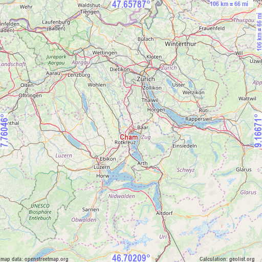
Cham GPS coordinates[2]
47° 10' 55.668" North, 8° 27' 48.888" East
| Map corner | latitude | longitude |
|---|---|---|
| Upper-left | 47.65787°, | 7.76046° |
| Center: | 47.18213°, | 8.46358° |
| Lower-right: | 46.70209°, | 9.16671° |
| Map W x H: | 106.3×106.3 km | = 66.1×66.1mi |
| max Lat: | 47.76737° ⇑54% North |
| Cham: | 47.18213° |
| min Lat: | ⇓46% South 45.83203° |
| min Long | Cham | max Long |
| 5.97153° | 8.46358° | 10.44624° |
| W 54.6%⇐ | ⇒45.4% E |
Elevation
Elevation of Cham is 424 m = 1391 ft, and this is 134.2 m = 440 ft below average elevation for this country.
| Max E: |
1845 m = 6053 ft | 78.9% |
| Avg. | 558.2 m = 1831 ft | |
| Cham | 424 m = 1391 ft | |
Min E: |
197 m = 646 ft | 21.1% |
See also: Switzerland elevation on elevation.city.
Geographical zone
Cham is located in North temperate zone (between Tropic of Cancer and the Arctic Circle). Distance of this North polar circle is 2155 km =1339.1 mi to North.| Distance of | km | miles | from Cham |
|---|---|---|---|
| North Pole | 4760.9 | 2958.3 | to North |
| Arctic Circle | 2155 | 1339.1 | to North |
| Tropic Cancer | 2640.2 | 1640.5 | to South |
| Equator | 5246.2 | 3259.8 | to South |


Nearby cities:
15 places around Cham: (largest is in red/bold)
• Auw
8 km =5 mi,  293°
293°
• Baar
5.2 km =3.2 mi,  72°
72°
• Dietwil
6.6 km =4.1 mi,  233°
233°
• Hausen am Albis / Hausen (Dorf)
8.7 km =5.4 mi,  36°
36°
• Hünenberg
3 km =1.9 mi,  255°
255°
• Knonau
4.6 km =2.9 mi,  358°
358°
• Meierskappel
6.6 km =4.1 mi,  193°
193°
• Mettmenstetten
7 km =4.3 mi, 359°
• Mühlau
7.7 km =4.8 mi,  312°
312°
• Oberrüti
5.5 km =3.4 mi,  251°
251°
• Rifferswil
7.3 km =4.5 mi,  20°
20°
• Rotkreuz
5 km =3.1 mi,  209°
209°
• Sins
5.4 km =3.4 mi,  282°
282°
• Steinhausen
2.2 km =1.4 mi,  49°
49°
• Zug
4.2 km =2.6 mi,  104°
104°
Sources, notices
• [Note1] Compared only with cities in Switzerland existing in our database
• [Src1] Map data: © OpenStreetMap contributors (CC-BY-SA)
• [Src2] Other city data from geonames.org with taken over terms of usage.
• [Src3] Geographical zone / Annual Mean Temperature by Robert A. Rohde @ Wikipedia
