Altnau geodata
Altnau (Thurgau) is a populated place; located in Switzerland in Europe/Zurich (GMT+2) time zone. With population of 1,887 people, there are 876 cities with bigger population in this country. Compared to other cities in Switzerland, 97.6% of cities are located further ↓South; 93.6% of cities are located further ←West and 69.1% of cities have higher elevation than Altnau. Note1


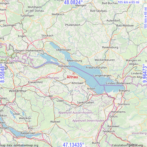
Altnau GPS coordinates[2]
47° 36' 37.872" North, 9° 15' 41.76" East
| Map corner | latitude | longitude |
|---|---|---|
| Upper-left | 48.0824°, | 8.55848° |
| Center: | 47.61052°, | 9.2616° |
| Lower-right: | 47.13435°, | 9.96473° |
| Map W x H: | 105.4×105.4 km | = 65.5×65.5mi |
| max Lat: | 47.76737° ⇑2.4% North |
| Altnau: | 47.61052° |
| min Lat: | ⇓97.6% South 45.83203° |
| min Long | Altnau | max Long |
| 5.97153° | 9.2616° | 10.44624° |
| W 93.6%⇐ | ⇒6.4% E |
Elevation
Elevation of Altnau is 440 m = 1444 ft, and this is 118.2 m = 388 ft below average elevation for this country.
| Max E: |
1845 m = 6053 ft | 69.1% |
| Avg. | 558.2 m = 1831 ft | |
| Altnau | 440 m = 1444 ft | |
Min E: |
197 m = 646 ft | 30.9% |
See also: Switzerland elevation on elevation.city.
Geographical zone
Altnau is located in North temperate zone (between Tropic of Cancer and the Arctic Circle). Distance of this North polar circle is 2107.4 km =1309.5 mi to North.| Distance of | km | miles | from Altnau |
|---|---|---|---|
| North Pole | 4713.3 | 2928.7 | to North |
| Arctic Circle | 2107.4 | 1309.5 | to North |
| Tropic Cancer | 2687.9 | 1670.2 | to South |
| Equator | 5293.8 | 3289.4 | to South |


Nearby cities:
15 places around Altnau: (largest is in red/bold)
• Amriswil
7.5 km =4.7 mi,  160°
160°
• Berg
8 km =5 mi,  243°
243°
• Bottighofen
4.9 km =3 mi,  306°
306°
• Bürglen
10.8 km =6.7 mi,  230°
230°
• Erlen
7.2 km =4.5 mi,  196°
196°
• Güttingen
2.1 km =1.3 mi,  111°
111°
• Kesswil
4.6 km =2.9 mi, 114°
• Kreuzlingen
7.9 km =4.9 mi,  304°
304°
• Langrickenbach
2.2 km =1.4 mi,  209°
209°
• Münsterlingen
3.2 km =2 mi,  317°
317°
• Romanshorn
10.1 km =6.3 mi,  119°
119°
• Salmsach
10.4 km =6.5 mi,  126°
126°
• Sulgen
9.7 km =6 mi,  215°
215°
• Tägerwilen
10.5 km =6.5 mi, 299°
• Uttwil
6.6 km =4.1 mi, 116°
Sources, notices
• [Note1] Compared only with cities in Switzerland existing in our database
• [Src1] Map data: © OpenStreetMap contributors (CC-BY-SA)
• [Src2] Other city data from geonames.org with taken over terms of usage.
• [Src3] Geographical zone / Annual Mean Temperature by Robert A. Rohde @ Wikipedia
