Langrickenbach geodata
Langrickenbach (Thurgau) is a populated place; located in Switzerland in Europe/Zurich (GMT+2) time zone. With population of 1,031 people, there are 1308 cities with bigger population in this country. Compared to other cities in Switzerland, 96.9% of cities are located further ↓South; 93.4% of cities are located further ←West and 60.7% of cities have lower elevation than Langrickenbach. Note1


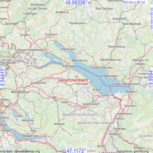
Langrickenbach GPS coordinates[2]
47° 35' 36.708" North, 9° 14' 50.172" East
| Map corner | latitude | longitude |
|---|---|---|
| Upper-left | 48.06556°, | 8.54415° |
| Center: | 47.59353°, | 9.24727° |
| Lower-right: | 47.1172°, | 9.9504° |
| Map W x H: | 105.4×105.4 km | = 65.5×65.5mi |
| max Lat: | 47.76737° ⇑3.1% North |
| Langrickenbach: | 47.59353° |
| min Lat: | ⇓96.9% South 45.83203° |
| min Long | Langrickenbach | max Long |
| 5.97153° | 9.24727° | 10.44624° |
| W 93.4%⇐ | ⇒6.6% E |
Elevation
Elevation of Langrickenbach is 522 m = 1713 ft, and this is 36.2 m = 119 ft below average elevation for this country.
| Max E: |
1845 m = 6053 ft | 39.3% |
| Avg. | 558.2 m = 1831 ft | |
| Langrickenbach | 522 m = 1713 ft | |
Min E: |
197 m = 646 ft | 60.7% |
See also: Switzerland elevation on elevation.city.
Geographical zone
Langrickenbach is located in North temperate zone (between Tropic of Cancer and the Arctic Circle). Distance of this North polar circle is 2109.3 km =1310.7 mi to North.| Distance of | km | miles | from Langrickenbach |
|---|---|---|---|
| North Pole | 4715.2 | 2929.9 | to North |
| Arctic Circle | 2109.3 | 1310.7 | to North |
| Tropic Cancer | 2686 | 1669 | to South |
| Equator | 5291.9 | 3288.2 | to South |


Nearby cities:
15 places around Langrickenbach: (largest is in red/bold)
• Altnau
2.2 km =1.4 mi,  29°
29°
• Amriswil
6.3 km =3.9 mi,  144°
144°
• Berg
6.3 km =3.9 mi,  254°
254°
• Bottighofen
5.6 km =3.5 mi,  328°
328°
• Bürglen
8.8 km =5.5 mi,  236°
236°
• Erlen
5.1 km =3.2 mi,  191°
191°
• Güttingen
3.2 km =2 mi,  69°
69°
• Hohentannen
9.6 km =6 mi, 190°
• Kesswil
5.2 km =3.2 mi,  90°
90°
• Kreuzlingen
8.3 km =5.2 mi,  319°
319°
• Muolen
9.9 km =6.2 mi, 144°
• Münsterlingen
4.4 km =2.7 mi,  345°
345°
• Romanshorn
10.3 km =6.4 mi,  107°
107°
• Sulgen
7.6 km =4.7 mi,  217°
217°
• Uttwil
7.1 km =4.4 mi,  98°
98°
Sources, notices
• [Note1] Compared only with cities in Switzerland existing in our database
• [Src1] Map data: © OpenStreetMap contributors (CC-BY-SA)
• [Src2] Other city data from geonames.org with taken over terms of usage.
• [Src3] Geographical zone / Annual Mean Temperature by Robert A. Rohde @ Wikipedia
