Berg geodata
Berg (Thurgau) is a populated place; located in Switzerland in Europe/Zurich (GMT+2) time zone. With population of 2,942 people, there are 596 cities with bigger population in this country. Compared to other cities in Switzerland, 96.3% of cities are located further ↓South; 92.3% of cities are located further ←West and 66.6% of cities have lower elevation than Berg. Note1


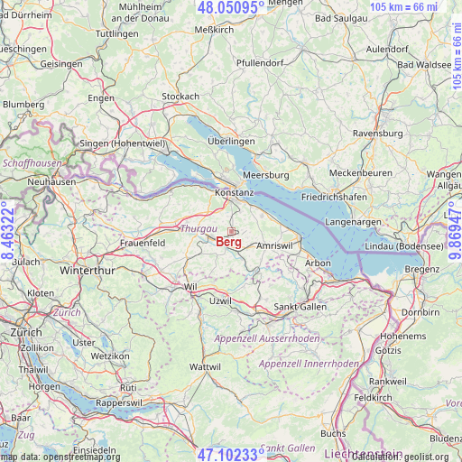
Berg GPS coordinates[2]
47° 34' 43.644" North, 9° 9' 58.86" East
| Map corner | latitude | longitude |
|---|---|---|
| Upper-left | 48.05095°, | 8.46322° |
| Center: | 47.57879°, | 9.16635° |
| Lower-right: | 47.10233°, | 9.86947° |
| Map W x H: | 105.5×105.5 km | = 65.6×65.6mi |
| max Lat: | 47.76737° ⇑3.7% North |
| Berg: | 47.57879° |
| min Lat: | ⇓96.3% South 45.83203° |
| min Long | Berg | max Long |
| 5.97153° | 9.16635° | 10.44624° |
| W 92.3%⇐ | ⇒7.7% E |
Elevation
Elevation of Berg is 554 m = 1818 ft, and this is 4.2 m = 14 ft below average elevation for this country.
| Max E: |
1845 m = 6053 ft | 33.4% |
| Avg. | 558.2 m = 1831 ft | |
| Berg | 554 m = 1818 ft | |
Min E: |
197 m = 646 ft | 66.6% |
See also: Switzerland elevation on elevation.city.
Geographical zone
Berg is located in North temperate zone (between Tropic of Cancer and the Arctic Circle). Distance of this North polar circle is 2110.9 km =1311.7 mi to North.| Distance of | km | miles | from Berg |
|---|---|---|---|
| North Pole | 4716.8 | 2930.9 | to North |
| Arctic Circle | 2110.9 | 1311.7 | to North |
| Tropic Cancer | 2684.3 | 1667.9 | to South |
| Equator | 5290.3 | 3287.2 | to South |


Nearby cities:
15 places around Berg: (largest is in red/bold)
• Altnau
8 km =5 mi,  63°
63°
• Bottighofen
7.2 km =4.5 mi,  26°
26°
• Bürglen
3.5 km =2.2 mi,  201°
201°
• Erlen
6.1 km =3.8 mi,  123°
123°
• Güttingen
9.5 km =5.9 mi,  73°
73°
• Hohentannen
9 km =5.6 mi,  150°
150°
• Kreuzlingen
8 km =5 mi,  4°
4°
• Langrickenbach
6.3 km =3.9 mi, 74°
• Märstetten-Dorf
7.5 km =4.7 mi,  281°
281°
• Münsterlingen
7.7 km =4.8 mi,  40°
40°
• Schönholzerswilen
7.1 km =4.4 mi, 195°
• Sulgen
4.6 km =2.9 mi,  161°
161°
• Tägerwilen
8.9 km =5.5 mi,  347°
347°
• Weinfelden
5.2 km =3.2 mi,  254°
254°
• Wäldi
8.2 km =5.1 mi,  319°
319°
Sources, notices
• [Note1] Compared only with cities in Switzerland existing in our database
• [Src1] Map data: © OpenStreetMap contributors (CC-BY-SA)
• [Src2] Other city data from geonames.org with taken over terms of usage.
• [Src3] Geographical zone / Annual Mean Temperature by Robert A. Rohde @ Wikipedia
