Alchenstorf geodata
Alchenstorf (Bern) is a populated place; located in Switzerland in Europe/Zurich (GMT+2) time zone. With population of 527 people, there are 1767 cities with bigger population in this country. Compared to other cities in Switzerland, 57.7% of cities are located further ↑North; 70.3% of cities are located further →East and 55.3% of cities have lower elevation than Alchenstorf. Note1


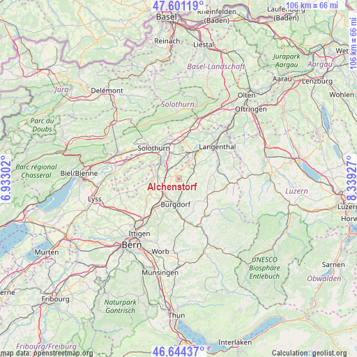
Alchenstorf GPS coordinates[2]
47° 7' 29.748" North, 7° 38' 10.104" East
| Map corner | latitude | longitude |
|---|---|---|
| Upper-left | 47.60119°, | 6.93302° |
| Center: | 47.12493°, | 7.63614° |
| Lower-right: | 46.64437°, | 8.33927° |
| Map W x H: | 106.4×106.4 km | = 66.1×66.1mi |
| max Lat: | 47.76737° ⇑57.7% North |
| Alchenstorf: | 47.12493° |
| min Lat: | ⇓42.3% South 45.83203° |
| min Long | Alchenstorf | max Long |
| 5.97153° | 7.63614° | 10.44624° |
| W 29.7%⇐ | ⇒70.3% E |
Elevation
Elevation of Alchenstorf is 497 m = 1631 ft, and this is 61.2 m = 201 ft below average elevation for this country.
| Max E: |
1845 m = 6053 ft | 44.7% |
| Avg. | 558.2 m = 1831 ft | |
| Alchenstorf | 497 m = 1631 ft | |
Min E: |
197 m = 646 ft | 55.3% |
See also: Switzerland elevation on elevation.city.
Geographical zone
Alchenstorf is located in North temperate zone (between Tropic of Cancer and the Arctic Circle). Distance of this North polar circle is 2161.4 km =1343 mi to North.| Distance of | km | miles | from Alchenstorf |
|---|---|---|---|
| North Pole | 4767.3 | 2962.3 | to North |
| Arctic Circle | 2161.4 | 1343 | to North |
| Tropic Cancer | 2633.9 | 1636.6 | to South |
| Equator | 5239.8 | 3255.9 | to South |


Nearby cities:
15 places around Alchenstorf: (largest is in red/bold)
• Biberist
8.3 km =5.2 mi,  317°
317°
• Burgdorf
7.4 km =4.6 mi,  184°
184°
• Bätterkinden
7.4 km =4.6 mi,  275°
275°
• Ersigen
4.7 km =2.9 mi,  221°
221°
• Gerlafingen
7 km =4.3 mi, 316°
• Heimiswil
6.8 km =4.2 mi,  160°
160°
• Kirchberg
6 km =3.7 mi, 222°
• Koppigen
2.4 km =1.5 mi,  286°
286°
• Kriegstetten
6.2 km =3.9 mi,  332°
332°
• Lyssach
7.9 km =4.9 mi,  211°
211°
• Oberönz
7.4 km =4.6 mi,  37°
37°
• Ochlenberg
8 km =5 mi,  70°
70°
• Seeberg
4.1 km =2.5 mi,  33°
33°
• Utzenstorf
6.3 km =3.9 mi, 277°
• Wynigen
3.1 km =1.9 mi,  132°
132°
Sources, notices
• [Note1] Compared only with cities in Switzerland existing in our database
• [Src1] Map data: © OpenStreetMap contributors (CC-BY-SA)
• [Src2] Other city data from geonames.org with taken over terms of usage.
• [Src3] Geographical zone / Annual Mean Temperature by Robert A. Rohde @ Wikipedia
