Oberönz geodata
Oberönz (Bern) is a populated place; located in Switzerland in Europe/Zurich (GMT+2) time zone. With population of 879 people, there are 1433 cities with bigger population in this country. Compared to other cities in Switzerland, 54.3% of cities are located further ↑North; 68.4% of cities are located further →East and 56% of cities have higher elevation than Oberönz. Note1


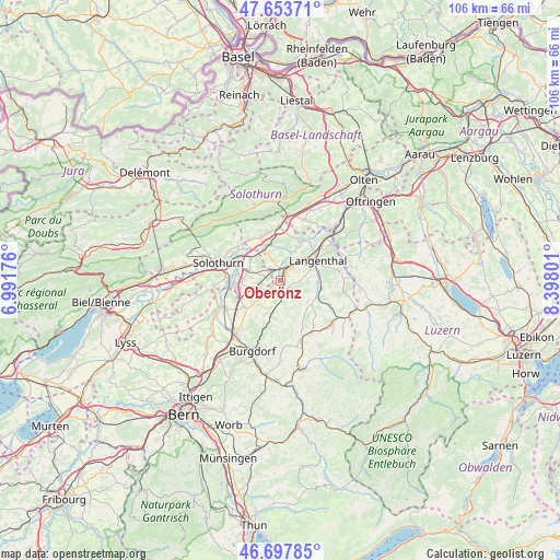
Oberönz GPS coordinates[2]
47° 10' 40.548" North, 7° 41' 41.604" East
| Map corner | latitude | longitude |
|---|---|---|
| Upper-left | 47.65371°, | 6.99176° |
| Center: | 47.17793°, | 7.69489° |
| Lower-right: | 46.69785°, | 8.39801° |
| Map W x H: | 106.3×106.3 km | = 66.1×66.1mi |
| max Lat: | 47.76737° ⇑54.3% North |
| Oberönz: | 47.17793° |
| min Lat: | ⇓45.7% South 45.83203° |
| min Long | Oberönz | max Long |
| 5.97153° | 7.69489° | 10.44624° |
| W 31.6%⇐ | ⇒68.4% E |
Elevation
Elevation of Oberönz is 465 m = 1526 ft, and this is 93.2 m = 306 ft below average elevation for this country.
| Max E: |
1845 m = 6053 ft | 56% |
| Avg. | 558.2 m = 1831 ft | |
| Oberönz | 465 m = 1526 ft | |
Min E: |
197 m = 646 ft | 44% |
See also: Switzerland elevation on elevation.city.
Geographical zone
Oberönz is located in North temperate zone (between Tropic of Cancer and the Arctic Circle). Distance of this North polar circle is 2155.5 km =1339.4 mi to North.| Distance of | km | miles | from Oberönz |
|---|---|---|---|
| North Pole | 4761.4 | 2958.6 | to North |
| Arctic Circle | 2155.5 | 1339.4 | to North |
| Tropic Cancer | 2639.8 | 1640.3 | to South |
| Equator | 5245.7 | 3259.5 | to South |


Nearby cities:
15 places around Oberönz: (largest is in red/bold)
• Alchenstorf
7.4 km =4.6 mi,  217°
217°
• Bannwil
7.6 km =4.7 mi,  24°
24°
• Deitingen
7.1 km =4.4 mi,  305°
305°
• Herzogenbuchsee
1.4 km =0.9 mi,  37°
37°
• Kleindietwil
8 km =5 mi,  116°
116°
• Kriegstetten
7.3 km =4.5 mi,  267°
267°
• Lotzwil
7.4 km =4.6 mi,  78°
78°
• Madiswil
8 km =5 mi,  100°
100°
• Ochlenberg
4.4 km =2.7 mi,  135°
135°
• Seeberg
3.3 km =2.1 mi, 221°
• Subingen
6.1 km =3.8 mi,  291°
291°
• Ursenbach
7.4 km =4.6 mi,  128°
128°
• Walliswil bei Niederbipp
6.5 km =4 mi,  356°
356°
• Wangen an der Aare
6.8 km =4.2 mi,  332°
332°
• Wynigen
8.3 km =5.2 mi,  194°
194°
Sources, notices
• [Note1] Compared only with cities in Switzerland existing in our database
• [Src1] Map data: © OpenStreetMap contributors (CC-BY-SA)
• [Src2] Other city data from geonames.org with taken over terms of usage.
• [Src3] Geographical zone / Annual Mean Temperature by Robert A. Rohde @ Wikipedia
