Arboldswil geodata
Arboldswil (Basel-Landschaft) is a populated place; located in Switzerland in Europe/Zurich (GMT+2) time zone. With population of 509 people, there are 1793 cities with bigger population in this country. Compared to other cities in Switzerland, 76.6% of cities are located further ↓South; 67.9% of cities are located further →East and 75.5% of cities have lower elevation than Arboldswil. Note1
Administrative division(s):
- Level 1: Basel-Landschaft
- Level 2: Bezirk Waldenburg
- Level 3: Arboldswil


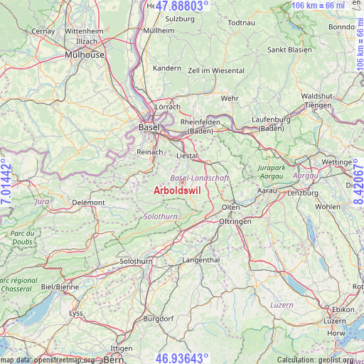
Arboldswil GPS coordinates[2]
47° 24' 51.768" North, 7° 43' 3.18" East
| Map corner | latitude | longitude |
|---|---|---|
| Upper-left | 47.88803°, | 7.01442° |
| Center: | 47.41438°, | 7.71755° |
| Lower-right: | 46.93643°, | 8.42067° |
| Map W x H: | 105.8×105.8 km | = 65.7×65.7mi |
| max Lat: | 47.76737° ⇑23.4% North |
| Arboldswil: | 47.41438° |
| min Lat: | ⇓76.6% South 45.83203° |
| min Long | Arboldswil | max Long |
| 5.97153° | 7.71755° | 10.44624° |
| W 32.1%⇐ | ⇒67.9% E |
Elevation
Elevation of Arboldswil is 622 m = 2041 ft, and this is 63.8 m = 209 ft above average elevation for this country.
| Max E: |
1845 m = 6053 ft | 24.5% |
| Arboldswil | 622 m 2041 ft | |
| Avg. | 558.2 m = 1831 ft | |
Min E: |
197 m = 646 ft | 75.5% |
See also: Switzerland elevation on elevation.city.
Geographical zone
Arboldswil is located in North temperate zone (between Tropic of Cancer and the Arctic Circle). Distance of this North polar circle is 2129.2 km =1323 mi to North.| Distance of | km | miles | from Arboldswil |
|---|---|---|---|
| North Pole | 4735.1 | 2942.3 | to North |
| Arctic Circle | 2129.2 | 1323 | to North |
| Tropic Cancer | 2666.1 | 1656.6 | to South |
| Equator | 5272 | 3275.9 | to South |


Nearby cities:
15 places around Arboldswil: (largest is in red/bold)
• Bretzwil
5.2 km =3.2 mi,  249°
249°
• Bubendorf
3.8 km =2.4 mi,  23°
23°
• Diegten
7 km =4.3 mi,  90°
90°
• Hochwald
7 km =4.3 mi,  308°
308°
• Hölstein
4.1 km =2.5 mi,  76°
76°
• Itingen
7.7 km =4.8 mi,  41°
41°
• Lausen
7.1 km =4.4 mi,  26°
26°
• Liestal
7.9 km =4.9 mi,  9°
9°
• Nunningen
7.7 km =4.8 mi, 253°
• Oberdorf
3.5 km =2.2 mi,  132°
132°
• Reigoldswil
2.9 km =1.8 mi,  231°
231°
• Seltisberg
5.4 km =3.4 mi,  2°
2°
• Tenniken
7.5 km =4.7 mi,  70°
70°
• Waldenburg
4.2 km =2.6 mi,  144°
144°
• Zunzgen
7.8 km =4.8 mi,  60°
60°
Sources, notices
• [Note1] Compared only with cities in Switzerland existing in our database
• [Src1] Map data: © OpenStreetMap contributors (CC-BY-SA)
• [Src2] Other city data from geonames.org with taken over terms of usage.
• [Src3] Geographical zone / Annual Mean Temperature by Robert A. Rohde @ Wikipedia
