Paine geodata
Paine (Santiago Metropolitan) is a populated place; located in Chile in America/Santiago (GMT-4) time zone. With population of 32,766 people, there are 51 cities with bigger population in this country. Compared to other cities in Chile, 64.1% of cities are located further ↓South; 78.6% of cities are located further ←West and 82.1% of cities have lower elevation than Paine. Note1
Administrative division(s):
- Level 1: Santiago Metropolitan
- Level 2: Provincia de Maipo
- Level 3: Paine


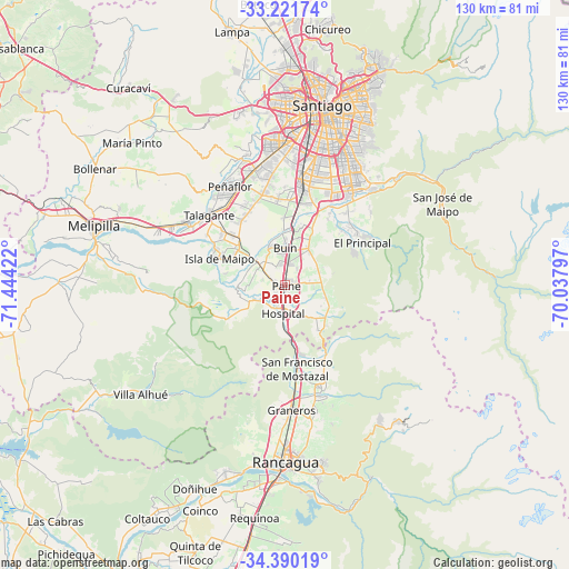
Paine GPS coordinates[2]
33° 48' 28.656" South, 70° 44' 27.924" West
| Map corner | latitude | longitude |
|---|---|---|
| Upper-left | -33.22174°, | -71.44422° |
| Center: | -33.80796°, | -70.74109° |
| Lower-right: | -34.39019°, | -70.03797° |
| Map W x H: | 129.9×129.9 km | = 80.7×80.7mi |
| max Lat: | -18.19821° ⇑35.9% North |
| Paine: | -33.80796° |
| min Lat: | ⇓64.1% South -54.93355° |
| min Long | Paine | max Long |
| -109.42438° | -70.74109° | -67.60963° |
| W 78.6%⇐ | ⇒21.4% E |
Elevation
Elevation of Paine is 407 m = 1335 ft, and this is 134 m = 440 ft above average elevation for this country.
| Max E: |
3544 m = 11627 ft | 17.9% |
| Paine | 407 m 1335 ft | |
| Avg. | 273 m = 896 ft | |
Min E: |
1 m = 3 ft | 82.1% |
See also: Chile elevation on elevation.city.
Geographical zone
Paine is located in South temperate zone (between Tropic of Capricorn and the Antarctic Circle). Distance of this Southern Tropic circle is 1153.2 km =716.6 mi to North.| Distance of | km | miles | from Paine |
|---|---|---|---|
| Equator | 3759.1 | 2335.8 | to North |
| Tropic Capricorn | 1153.2 | 716.6 | to North |
| Antarctic Circle | 3642.1 | 2263.1 | to South |
| South Pole | 6248 | 3882.3 | to South |


Nearby cities:
15 places around Paine: (largest is in red/bold)
• Buin
8.4 km =5.2 mi,  358°
358°
• El Monte
26.7 km =16.6 mi,  302°
302°
• Graneros
29 km =18 mi,  177°
177°
• La Pintana
26.9 km =16.7 mi,  21°
21°
• Lo Prado
40.5 km =25.2 mi,  2°
2°
• Machalí
42.3 km =26.3 mi,  168°
168°
• Melipilla
45.8 km =28.5 mi,  286°
286°
• Peñaflor
25.7 km =16 mi,  330°
330°
• Providencia
43.8 km =27.2 mi, 16°
• Puente Alto
26.6 km =16.5 mi,  35°
35°
• Rancagua
40.3 km =25 mi, 180°
• San Bernardo
24.3 km =15.1 mi,  9°
9°
• Santiago
40 km =24.9 mi, 12°
• Talagante
23.5 km =14.6 mi,  312°
312°
• Villa Presidente Frei, Ñuñoa, Santiago, Chile
41.4 km =25.7 mi, 21°
Sources, notices
• [Note1] Compared only with cities in Chile existing in our database
• [Src1] Map data: © OpenStreetMap contributors (CC-BY-SA)
• [Src2] Other city data from geonames.org with taken over terms of usage.
• [Src3] Geographical zone / Annual Mean Temperature by Robert A. Rohde @ Wikipedia
