Graneros geodata
Graneros (O'Higgins Region) is a populated place; located in Chile in America/Santiago (GMT-4) time zone. With population of 23,301 people, there are 71 cities with bigger population in this country. Compared to other cities in Chile, 63.4% of cities are located further ↓South; 79.3% of cities are located further ←West and 83.4% of cities have lower elevation than Graneros. Note1
Administrative division(s):
- Level 1: O'Higgins Region
- Level 2: Provincia de Cachapoal
- Level 3: Graneros


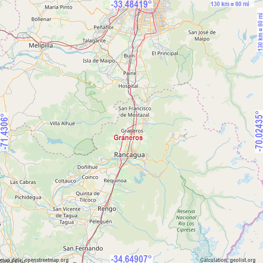
Graneros GPS coordinates[2]
34° 4' 7.068" South, 70° 43' 38.892" West
| Map corner | latitude | longitude |
|---|---|---|
| Upper-left | -33.48419°, | -71.4306° |
| Center: | -34.06863°, | -70.72747° |
| Lower-right: | -34.64907°, | -70.02435° |
| Map W x H: | 129.5×129.5 km | = 80.5×80.5mi |
| max Lat: | -18.19821° ⇑36.6% North |
| Graneros: | -34.06863° |
| min Lat: | ⇓63.4% South -54.93355° |
| min Long | Graneros | max Long |
| -109.42438° | -70.72747° | -67.60963° |
| W 79.3%⇐ | ⇒20.7% E |
Elevation
Elevation of Graneros is 483 m = 1585 ft, and this is 210 m = 689 ft above average elevation for this country.
| Max E: |
3544 m = 11627 ft | 16.6% |
| Graneros | 483 m 1585 ft | |
| Avg. | 273 m = 896 ft | |
Min E: |
1 m = 3 ft | 83.4% |
See also: Chile elevation on elevation.city.
Geographical zone
Graneros is located in South temperate zone (between Tropic of Capricorn and the Antarctic Circle). Distance of this Southern Tropic circle is 1182.2 km =734.6 mi to North.| Distance of | km | miles | from Graneros |
|---|---|---|---|
| Equator | 3788.1 | 2353.8 | to North |
| Tropic Capricorn | 1182.2 | 734.6 | to North |
| Antarctic Circle | 3613.1 | 2245.1 | to South |
| South Pole | 6219 | 3864.3 | to South |


Nearby cities:
15 places around Graneros: (largest is in red/bold)
• Buin
37.4 km =23.2 mi,  357°
357°
• El Monte
49.3 km =30.6 mi,  331°
331°
• La Pintana
54.6 km =33.9 mi,  9°
9°
• Machalí
14.4 km =8.9 mi,  150°
150°
• Melipilla
61.7 km =38.3 mi,  313°
313°
• Paine
29 km =18 mi, 357°
• Peñaflor
53.2 km =33.1 mi,  345°
345°
• Puente Alto
52.7 km =32.7 mi,  15°
15°
• Rancagua
11.5 km =7.1 mi,  187°
187°
• Rengo
39.4 km =24.5 mi,  197°
197°
• San Bernardo
53 km =32.9 mi,  2°
2°
• San Vicente
52.1 km =32.4 mi,  218°
218°
• San Vicente de Tagua Tagua
52.2 km =32.4 mi, 218°
• Santiago
68.4 km =42.5 mi, 6°
• Talagante
48.6 km =30.2 mi,  337°
337°
Sources, notices
• [Note1] Compared only with cities in Chile existing in our database
• [Src1] Map data: © OpenStreetMap contributors (CC-BY-SA)
• [Src2] Other city data from geonames.org with taken over terms of usage.
• [Src3] Geographical zone / Annual Mean Temperature by Robert A. Rohde @ Wikipedia
