Hanga Roa geodata
Hanga Roa (Valparaíso) is a seat of a second-order administrative division; located in Chile in Pacific/Easter (GMT-5) time zone. With population of 3,304 people, there are 122 cities with bigger population in this country. Compared to other cities in Chile, 91.7% of cities are located further ↓South; 100% of cities are located further →East and 71% of cities have higher elevation than Hanga Roa. Note1
Administrative division(s):
- Level 1: Valparaíso
- Level 2: Provincia de Isla de Pascua
- Level 3: Isla de Pascua


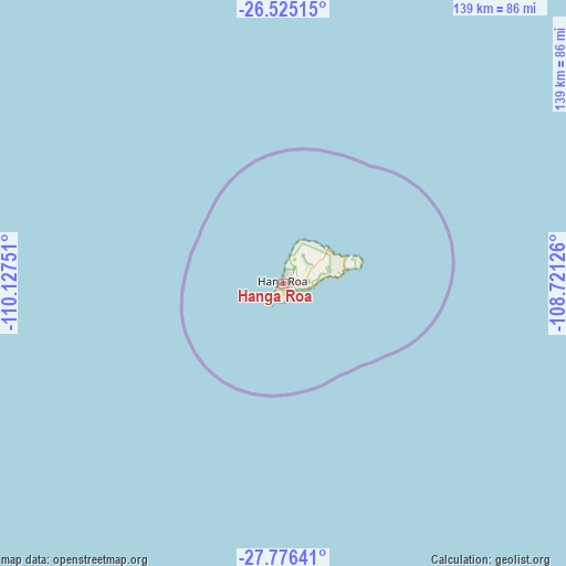
Hanga Roa GPS coordinates[2]
27° 9' 9.108" South, 109° 25' 27.768" West
| Map corner | latitude | longitude |
|---|---|---|
| Upper-left | -26.52515°, | -110.12751° |
| Center: | -27.15253°, | -109.42438° |
| Lower-right: | -27.77641°, | -108.72126° |
| Map W x H: | 139.1×139.1 km | = 86.4×86.4mi |
| max Lat: | -18.19821° ⇑8.3% North |
| Hanga Roa: | -27.15253° |
| min Lat: | ⇓91.7% South -54.93355° |
| min Long | Hanga Roa | max Long |
| -109.42438° | -109.42438° | -67.60963° |
| W 0%⇐ | ⇒100% E |
Elevation
Elevation of Hanga Roa is 41 m = 135 ft, and this is 232 m = 761 ft below average elevation for this country.
| Max E: |
3544 m = 11627 ft | 71% |
| Avg. | 273 m = 896 ft | |
| Hanga Roa | 41 m = 135 ft | |
Min E: |
1 m = 3 ft | 29% |
See also: Chile elevation on elevation.city.
Geographical zone
Hanga Roa is located in South temperate zone (between Tropic of Capricorn and the Antarctic Circle). Distance of this Southern Tropic circle is 413.2 km =256.8 mi to North.| Distance of | km | miles | from Hanga Roa |
|---|---|---|---|
| Equator | 3019.1 | 1876 | to North |
| Tropic Capricorn | 413.2 | 256.8 | to North |
| Antarctic Circle | 4382.1 | 2722.9 | to South |
| South Pole | 6988 | 4342.1 | to South |


Nearby cities:
15 places around Hanga Roa: (largest is in red/bold)
• Arauco
3553 km =2207.7 mi,  108°
108°
• Carahue
3591.7 km =2231.8 mi, 110°
• Cañete
3555 km =2209 mi, 109°
• Chiguayante
3573.8 km =2220.7 mi, 107°
• Concepción
3570.6 km =2218.7 mi, 107°
• Coronel
3565.5 km =2215.5 mi, 107°
• Corral
3593.9 km =2233.1 mi, 113°
• Curanilahue
3554.2 km =2208.5 mi, 108°
• Laja
3606.8 km =2241.2 mi, 108°
• Lebu
3529.4 km =2193.1 mi, 109°
• Lota
3564.7 km =2215 mi, 107°
• Penco
3574.3 km =2221 mi, 107°
• Talcahuano
3563.3 km =2214.1 mi, 107°
• Tomé
3576.2 km =2222.1 mi, 107°
• Valdivia
3607.7 km =2241.7 mi, 112°
Sources, notices
• [Note1] Compared only with cities in Chile existing in our database
• [Src1] Map data: © OpenStreetMap contributors (CC-BY-SA)
• [Src2] Other city data from geonames.org with taken over terms of usage.
• [Src3] Geographical zone / Annual Mean Temperature by Robert A. Rohde @ Wikipedia
