Limbe geodata
Limbe (South-West) is a populated place; located in Cameroon in Africa/Douala (GMT+1) time zone. With population of 72,106 people, there are 25 cities with bigger population in this country. Compared to other cities in Cameroon, 82% of cities are located further ↑North; 98.4% of cities are located further →East and 90.2% of cities have higher elevation than Limbe. Note1


Limbe GPS coordinates[2]
4° 1' 24.816" North, 9° 12' 21.852" East
| Map corner | latitude | longitude |
|---|---|---|
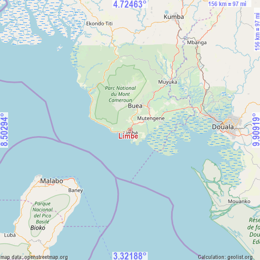
| Upper-left | 4.72463°, | 8.50294° |
| Center: | 4.02356°, | 9.20607° |
| Lower-right: | 3.32188°, | 9.90919° |
| Map W x H: | 156×156 km | = 96.9×96.9mi |
| max Lat: | 12.57535° ⇑82% North |
| Limbe: | 4.02356° |
| min Lat: | ⇓18% South 2.35° |
| min Long | Limbe | max Long |
| 8.8724° | 9.20607° | 15.23288° |
| W 1.6%⇐ | ⇒98.4% E |
Elevation
Elevation of Limbe is 74 m = 243 ft, and this is 599.9 m = 1968 ft below average elevation for this country.
| Max E: |
1687 m = 5535 ft | 90.2% |
| Avg. | 673.9 m = 2211 ft | |
| Limbe | 74 m = 243 ft | |
Min E: |
1 m = 3 ft | 9.8% |
See also: Limbe elevation on elevation.city.
Geographical zone
Limbe is located in North Torrid zone (between Equator and Tropic of Cancer). Distance of Equator is 447.4 km =278 mi to South.| Distance of | km | miles | from Limbe |
|---|---|---|---|
| North Pole | 9559.7 | 5940.1 | to North |
| Arctic Circle | 6953.8 | 4320.9 | to North |
| Tropic Cancer | 2158.5 | 1341.2 | to North |
| Equator | 447.4 | 278 | to South |


Nearby cities:
15 places around Limbe: (largest is in red/bold)
• Bamusso
59 km =36.7 mi,  325°
325°
• Bekondo
74.3 km =46.2 mi,  9°
9°
• Bonabéri
53 km =32.9 mi,  84°
84°
• Buea
15 km =9.3 mi,  15°
15°
• Dibombari
52.8 km =32.8 mi,  70°
70°
• Dizangué
90.8 km =56.4 mi,  108°
108°
• Douala
55.3 km =34.4 mi,  87°
87°
• Kumba
73.2 km =45.5 mi, 21°
• Mbanga
66.5 km =41.3 mi,  36°
36°
• Mouanko
76.4 km =47.5 mi,  123°
123°
• Mutengene
14.2 km =8.8 mi,  57°
57°
• Muyuka
37.3 km =23.2 mi, 37°
• Ndom
65.9 km =40.9 mi, 36°
• Penja
86.3 km =53.6 mi, 37°
• Tiko
18 km =11.2 mi, 71°
Sources, notices
• [Note1] Compared only with cities in Cameroon existing in our database
• [Src1] Map data: © OpenStreetMap contributors (CC-BY-SA)
• [Src2] Other city data from geonames.org with taken over terms of usage.
• [Src3] Geographical zone / Annual Mean Temperature by Robert A. Rohde @ Wikipedia
