Bankim geodata
Bankim (Adamaoua) is a populated place; located in Cameroon in Africa/Douala (GMT+1) time zone. With population of 5,727 people, there are 93 cities with bigger population in this country. Compared to other cities in Cameroon, 72.1% of cities are located further ↓South; 59% of cities are located further ←West and 63.9% of cities have lower elevation than Bankim. Note1


Bankim GPS coordinates[2]
6° 4' 58.908" North, 11° 29' 25.8" East
| Map corner | latitude | longitude |
|---|---|---|
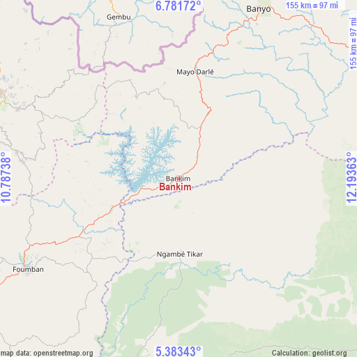
| Upper-left | 6.78172°, | 10.78738° |
| Center: | 6.08303°, | 11.4905° |
| Lower-right: | 5.38343°, | 12.19363° |
| Map W x H: | 155.5×155.5 km | = 96.6×96.6mi |
| max Lat: | 12.57535° ⇑27.9% North |
| Bankim: | 6.08303° |
| min Lat: | ⇓72.1% South 2.35° |
| min Long | Bankim | max Long |
| 8.8724° | 11.4905° | 15.23288° |
| W 59%⇐ | ⇒41% E |
Elevation
Elevation of Bankim is 731 m = 2398 ft, and this is 57.1 m = 187 ft above average elevation for this country.
| Max E: |
1687 m = 5535 ft | 36.1% |
| Bankim | 731 m 2398 ft | |
| Avg. | 673.9 m = 2211 ft | |
Min E: |
1 m = 3 ft | 63.9% |
See also: Cameroon elevation on elevation.city.
Geographical zone
Bankim is located in North Torrid zone (between Equator and Tropic of Cancer). Distance of Equator is 676.4 km =420.3 mi to South.| Distance of | km | miles | from Bankim |
|---|---|---|---|
| North Pole | 9330.7 | 5797.8 | to North |
| Arctic Circle | 6724.8 | 4178.6 | to North |
| Tropic Cancer | 1929.5 | 1198.9 | to North |
| Equator | 676.4 | 420.3 | to South |


Nearby cities:
15 places around Bankim: (largest is in red/bold)
• Babanki
137.2 km =85.3 mi,  271°
271°
• Bafoussam
136.4 km =84.8 mi,  240°
240°
• Banyo
82.5 km =51.3 mi,  25°
25°
• Belo
137.3 km =85.3 mi, 272°
• Foumban
76.5 km =47.5 mi, 238°
• Foumbot
114.4 km =71.1 mi, 236°
• Fundong
136.6 km =84.9 mi,  277°
277°
• Jakiri
92.9 km =57.7 mi, 271°
• Kumbo
92 km =57.2 mi, 278°
• Mme-Bafumen
141.7 km =88 mi, 281°
• Ngoro
126.5 km =78.6 mi,  185°
185°
• Njinikom
134.5 km =83.6 mi, 277°
• Somié
42.2 km =26.2 mi,  351°
351°
• Tibati
132.7 km =82.5 mi,  71°
71°
• Yoko
109.9 km =68.3 mi,  123°
123°
Sources, notices
• [Note1] Compared only with cities in Cameroon existing in our database
• [Src1] Map data: © OpenStreetMap contributors (CC-BY-SA)
• [Src2] Other city data from geonames.org with taken over terms of usage.
• [Src3] Geographical zone / Annual Mean Temperature by Robert A. Rohde @ Wikipedia
