Songbai geodata
Songbai (Hubei) is a seat of a third-order administrative division; located in China in Asia/Shanghai (GMT+8) time zone. In our database, there are 1268 cities with bigger population. Compared to other cities in China, 59.9% of cities are located further ↓South; 68.4% of cities are located further →East and 87.7% of cities have lower elevation than Songbai. Note1


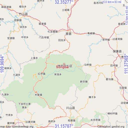
Songbai GPS coordinates[2]
31° 45' 24.66" North, 110° 40' 21.072" East
| Map corner | latitude | longitude |
|---|---|---|
| Upper-left | 32.35277°, | 109.9694° |
| Center: | 31.75685°, | 110.67252° |
| Lower-right: | 31.15707°, | 111.37565° |
| Map W x H: | 132.9×133 km | = 82.6×82.6mi |
| max Lat: | 53.31946° ⇑40.1% North |
| Songbai: | 31.75685° |
| min Lat: | ⇓59.9% South 18.22056° |
| min Long | Songbai | max Long |
| 75.07348° | 110.67252° | 134.28917° |
| W 31.6%⇐ | ⇒68.4% E |
Elevation
Elevation of Songbai is 1166 m = 3825 ft, and this is 681.2 m = 2235 ft above average elevation for this country.
| Max E: |
5622 m = 18445 ft | 12.3% |
| Songbai | 1166 m 3825 ft | |
| Avg. | 484.8 m = 1591 ft | |
Min E: |
-3 m = -10 ft | 87.7% |
See also: China elevation on elevation.city.
Geographical zone
Songbai is located in North temperate zone (between Tropic of Cancer and the Arctic Circle). Distance of this Northern Tropic circle is 925.1 km =574.8 mi to South.| Distance of | km | miles | from Songbai |
|---|---|---|---|
| North Pole | 6476 | 4024 | to North |
| Arctic Circle | 3870.1 | 2404.8 | to North |
| Tropic Cancer | 925.1 | 574.8 | to South |
| Equator | 3531 | 2194.1 | to South |


Nearby cities:
15 places around Songbai: (largest is in red/bold)
• Fangxian Chengguanzhen
33.7 km =20.9 mi,  9°
9°
• Gufu
44.2 km =27.5 mi,  173°
173°
• Hongping
25.4 km =15.8 mi,  247°
247°
• Houping
52 km =32.3 mi,  91°
91°
• Hualongyan
36.1 km =22.4 mi,  340°
340°
• Jundian
33.8 km =21 mi,  351°
351°
• Maqiao
24.5 km =15.2 mi, 90°
• Mengusi
35 km =21.7 mi,  323°
323°
• Muyu
41.6 km =25.8 mi,  220°
220°
• Nanyang
49.2 km =30.6 mi,  180°
180°
• Qingfeng
42.5 km =26.4 mi,  40°
40°
• Siping
50.4 km =31.3 mi,  59°
59°
• Xiema
49.7 km =30.9 mi,  108°
108°
• Yangri
13.6 km =8.5 mi,  97°
97°
• Zhenzi
44.6 km =27.7 mi,  139°
139°
Sources, notices
• [Note1] Compared only with cities in China existing in our database
• [Src1] Map data: © OpenStreetMap contributors (CC-BY-SA)
• [Src2] Other city data from geonames.org with taken over terms of usage.
• [Src3] Geographical zone / Annual Mean Temperature by Robert A. Rohde @ Wikipedia
