Yangfanglin geodata
Yangfanglin (Hubei) is a seat of a fourth-order administrative division; located in China in Asia/Shanghai (GMT+8) time zone. In our database, there are 1268 cities with bigger population. Compared to other cities in China, 59.9% of cities are located further ↑North; 50.7% of cities are located further ←West and 55.1% of cities have higher elevation than Yangfanglin. Note1


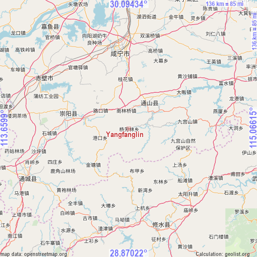
Yangfanglin GPS coordinates[2]
29° 29' 2.868" North, 114° 21' 46.872" East
| Map corner | latitude | longitude |
|---|---|---|
| Upper-left | 30.09434°, | 113.6599° |
| Center: | 29.48413°, | 114.36302° |
| Lower-right: | 28.87022°, | 115.06615° |
| Map W x H: | 136.1×136.1 km | = 84.6×84.6mi |
| max Lat: | 53.31946° ⇑59.9% North |
| Yangfanglin: | 29.48413° |
| min Lat: | ⇓40.1% South 18.22056° |
| min Long | Yangfanglin | max Long |
| 75.07348° | 114.36302° | 134.28917° |
| W 50.7%⇐ | ⇒49.3% E |
Elevation
Elevation of Yangfanglin is 131 m = 430 ft, and this is 353.8 m = 1161 ft below average elevation for this country.
| Max E: |
5622 m = 18445 ft | 55.1% |
| Avg. | 484.8 m = 1591 ft | |
| Yangfanglin | 131 m = 430 ft | |
Min E: |
-3 m = -10 ft | 44.9% |
See also: China elevation on elevation.city.
Geographical zone
Yangfanglin is located in North temperate zone (between Tropic of Cancer and the Arctic Circle). Distance of this Northern Tropic circle is 672.4 km =417.8 mi to South.| Distance of | km | miles | from Yangfanglin |
|---|---|---|---|
| North Pole | 6728.7 | 4181 | to North |
| Arctic Circle | 4122.8 | 2561.8 | to North |
| Tropic Cancer | 672.4 | 417.8 | to South |
| Equator | 3278.3 | 2037 | to South |


Nearby cities:
15 places around Yangfanglin: (largest is in red/bold)
• Baini
23.3 km =14.5 mi,  284°
284°
• Bujia
22.5 km =14 mi,  168°
168°
• Chuangwang
24.8 km =15.4 mi,  87°
87°
• Dalu
14.4 km =8.9 mi,  27°
27°
• Gangkou
16.3 km =10.1 mi,  252°
252°
• Gangkou
25.4 km =15.8 mi,  186°
186°
• Guihua
26 km =16.2 mi,  356°
356°
• Jintang
26.6 km =16.5 mi,  224°
224°
• Jiugongshan
31.1 km =19.3 mi,  82°
82°
• Lukou
18 km =11.2 mi,  302°
302°
• Nanlinqiao
9.9 km =6.2 mi,  351°
351°
• Tiancheng
31.7 km =19.7 mi, 281°
• Tongyang
30.7 km =19.1 mi,  47°
47°
• Tongzhong
24.9 km =15.5 mi,  267°
267°
• Xiapu
10.4 km =6.5 mi,  71°
71°
Sources, notices
• [Note1] Compared only with cities in China existing in our database
• [Src1] Map data: © OpenStreetMap contributors (CC-BY-SA)
• [Src2] Other city data from geonames.org with taken over terms of usage.
• [Src3] Geographical zone / Annual Mean Temperature by Robert A. Rohde @ Wikipedia
