Tongxihe geodata
Tongxihe (Hunan) is a populated place; located in China in Asia/Shanghai (GMT+8) time zone. With population of 630 people, there are 1244 cities with bigger population in this country. Compared to other cities in China, 75.5% of cities are located further ↑North; 68.8% of cities are located further →East and 59.9% of cities have lower elevation than Tongxihe. Note1


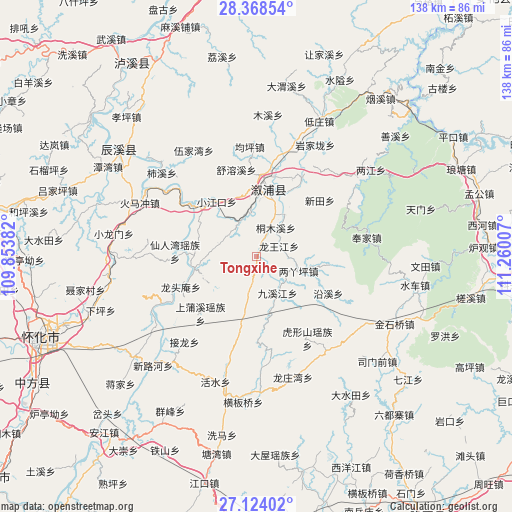
Tongxihe GPS coordinates[2]
27° 44' 53.016" North, 110° 33' 24.984" East
| Map corner | latitude | longitude |
|---|---|---|
| Upper-left | 28.36854°, | 109.85382° |
| Center: | 27.74806°, | 110.55694° |
| Lower-right: | 27.12402°, | 111.26007° |
| Map W x H: | 138.4×138.4 km | = 86×86mi |
| max Lat: | 53.31946° ⇑75.5% North |
| Tongxihe: | 27.74806° |
| min Lat: | ⇓24.5% South 18.22056° |
| min Long | Tongxihe | max Long |
| 75.07348° | 110.55694° | 134.28917° |
| W 31.2%⇐ | ⇒68.8% E |
Elevation
Elevation of Tongxihe is 258 m = 846 ft, and this is 226.8 m = 744 ft below average elevation for this country.
| Max E: |
5622 m = 18445 ft | 40.1% |
| Avg. | 484.8 m = 1591 ft | |
| Tongxihe | 258 m = 846 ft | |
Min E: |
-3 m = -10 ft | 59.9% |
See also: China elevation on elevation.city.
Geographical zone
Tongxihe is located in North temperate zone (between Tropic of Cancer and the Arctic Circle). Distance of this Northern Tropic circle is 479.4 km =297.9 mi to South.| Distance of | km | miles | from Tongxihe |
|---|---|---|---|
| North Pole | 6921.8 | 4301 | to North |
| Arctic Circle | 4315.9 | 2681.8 | to North |
| Tropic Cancer | 479.4 | 297.9 | to South |
| Equator | 3085.3 | 1917.1 | to South |


Nearby cities:
15 places around Tongxihe: (largest is in red/bold)
• Gangdong
33.1 km =20.6 mi,  55°
55°
• Guanyinge
28.5 km =17.7 mi,  11°
11°
• Huangxikou
17.2 km =10.7 mi,  259°
259°
• Huxingshan
26.1 km =16.2 mi,  148°
148°
• Jiuxijiang
11.7 km =7.3 mi, 151°
• Liangyaping
11.7 km =7.3 mi,  106°
106°
• Longtou’an
23.4 km =14.5 mi,  248°
248°
• Lufeng
18.2 km =11.3 mi, 8°
• Qiaojiang
24.1 km =15 mi,  29°
29°
• Tongmuxi
9.3 km =5.8 mi, 34°
• Tongwan
33.2 km =20.6 mi,  236°
236°
• Xianrenwan
22.4 km =13.9 mi,  271°
271°
• Xiaohenglong
16.4 km =10.2 mi,  193°
193°
• Xiaojiangkou
18.3 km =11.4 mi,  323°
323°
• Xiaoshajiang
31.5 km =19.6 mi,  143°
143°
Sources, notices
• [Note1] Compared only with cities in China existing in our database
• [Src1] Map data: © OpenStreetMap contributors (CC-BY-SA)
• [Src2] Other city data from geonames.org with taken over terms of usage.
• [Src3] Geographical zone / Annual Mean Temperature by Robert A. Rohde @ Wikipedia
