Tongwan geodata
Tongwan (Hunan) is a populated place; located in China in Asia/Shanghai (GMT+8) time zone. With population of 2,530 people, there are 982 cities with bigger population in this country. Compared to other cities in China, 76.3% of cities are located further ↑North; 70.1% of cities are located further →East and 51.1% of cities have lower elevation than Tongwan. Note1


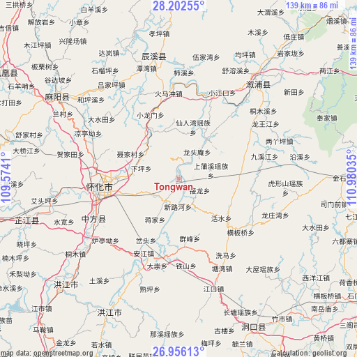
Tongwan GPS coordinates[2]
27° 34' 51.996" North, 110° 16' 37.992" East
| Map corner | latitude | longitude |
|---|---|---|
| Upper-left | 28.20255°, | 109.5741° |
| Center: | 27.58111°, | 110.27722° |
| Lower-right: | 26.95613°, | 110.98035° |
| Map W x H: | 138.6×138.6 km | = 86.1×86.1mi |
| max Lat: | 53.31946° ⇑76.3% North |
| Tongwan: | 27.58111° |
| min Lat: | ⇓23.7% South 18.22056° |
| min Long | Tongwan | max Long |
| 75.07348° | 110.27722° | 134.28917° |
| W 29.9%⇐ | ⇒70.1% E |
Elevation
Elevation of Tongwan is 174 m = 571 ft, and this is 310.8 m = 1020 ft below average elevation for this country.
| Max E: |
5622 m = 18445 ft | 48.9% |
| Avg. | 484.8 m = 1591 ft | |
| Tongwan | 174 m = 571 ft | |
Min E: |
-3 m = -10 ft | 51.1% |
See also: China elevation on elevation.city.
Geographical zone
Tongwan is located in North temperate zone (between Tropic of Cancer and the Arctic Circle). Distance of this Northern Tropic circle is 460.8 km =286.3 mi to South.| Distance of | km | miles | from Tongwan |
|---|---|---|---|
| North Pole | 6940.3 | 4312.5 | to North |
| Arctic Circle | 4334.4 | 2693.3 | to North |
| Tropic Cancer | 460.8 | 286.3 | to South |
| Equator | 3066.7 | 1905.6 | to South |


Nearby cities:
15 places around Tongwan: (largest is in red/bold)
• Anjiang
33.8 km =21 mi,  210°
210°
• Daping
26.9 km =16.7 mi,  174°
174°
• Huaihua
27 km =16.8 mi,  265°
265°
• Huangjin’ao
33.3 km =20.7 mi,  283°
283°
• Huangmaoyuan
27.7 km =17.2 mi,  135°
135°
• Huangxikou
18.6 km =11.6 mi,  34°
34°
• Huaqiao
19.4 km =12.1 mi,  316°
316°
• Longtan
31.8 km =19.8 mi,  126°
126°
• Longtou’an
11.5 km =7.1 mi, 30°
• Luyang
18.2 km =11.3 mi,  285°
285°
• Tiepo
16.8 km =10.4 mi, 143°
• Tongxihe
33.2 km =20.6 mi,  56°
56°
• Xianrenwan
20 km =12.4 mi,  15°
15°
• Xiaohenglong
23.8 km =14.8 mi,  83°
83°
• Xiaolongmen
27.1 km =16.8 mi,  334°
334°
Sources, notices
• [Note1] Compared only with cities in China existing in our database
• [Src1] Map data: © OpenStreetMap contributors (CC-BY-SA)
• [Src2] Other city data from geonames.org with taken over terms of usage.
• [Src3] Geographical zone / Annual Mean Temperature by Robert A. Rohde @ Wikipedia
