Huangxikou geodata
Huangxikou (Hunan) is a populated place; located in China in Asia/Shanghai (GMT+8) time zone. With population of 1,770 people, there are 1057 cities with bigger population in this country. Compared to other cities in China, 75.6% of cities are located further ↑North; 69.6% of cities are located further →East and 54.6% of cities have higher elevation than Huangxikou. Note1


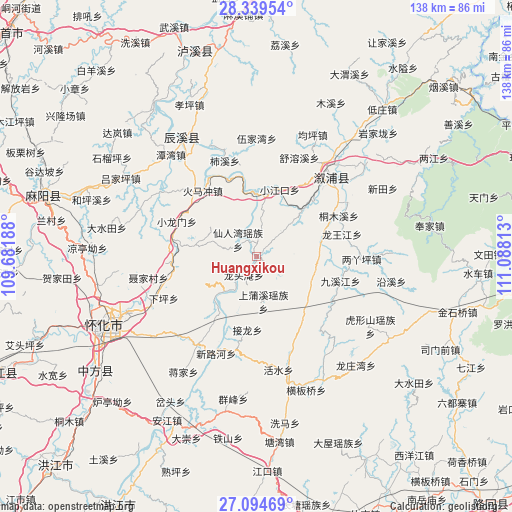
Huangxikou GPS coordinates[2]
27° 43' 8.004" North, 110° 23' 6" East
| Map corner | latitude | longitude |
|---|---|---|
| Upper-left | 28.33954°, | 109.68188° |
| Center: | 27.71889°, | 110.385° |
| Lower-right: | 27.09469°, | 111.08813° |
| Map W x H: | 138.4×138.4 km | = 86×86mi |
| max Lat: | 53.31946° ⇑75.6% North |
| Huangxikou: | 27.71889° |
| min Lat: | ⇓24.4% South 18.22056° |
| min Long | Huangxikou | max Long |
| 75.07348° | 110.385° | 134.28917° |
| W 30.4%⇐ | ⇒69.6% E |
Elevation
Elevation of Huangxikou is 134 m = 440 ft, and this is 350.8 m = 1151 ft below average elevation for this country.
| Max E: |
5622 m = 18445 ft | 54.6% |
| Avg. | 484.8 m = 1591 ft | |
| Huangxikou | 134 m = 440 ft | |
Min E: |
-3 m = -10 ft | 45.4% |
See also: China elevation on elevation.city.
Geographical zone
Huangxikou is located in North temperate zone (between Tropic of Cancer and the Arctic Circle). Distance of this Northern Tropic circle is 476.1 km =295.8 mi to South.| Distance of | km | miles | from Huangxikou |
|---|---|---|---|
| North Pole | 6925 | 4303 | to North |
| Arctic Circle | 4319.1 | 2683.8 | to North |
| Tropic Cancer | 476.1 | 295.8 | to South |
| Equator | 3082.1 | 1915.1 | to South |


Nearby cities:
15 places around Huangxikou: (largest is in red/bold)
• Huaqiao
24 km =14.9 mi,  267°
267°
• Huomachong
23.8 km =14.8 mi,  320°
320°
• Jiuxijiang
23.6 km =14.7 mi,  107°
107°
• Liangyaping
28.1 km =17.5 mi,  90°
90°
• Longtou’an
7.2 km =4.5 mi,  221°
221°
• Lufeng
29 km =18 mi,  42°
42°
• Luyang
30.1 km =18.7 mi,  249°
249°
• Tiepo
28.9 km =18 mi,  181°
181°
• Tongmuxi
24.7 km =15.3 mi,  63°
63°
• Tongwan
18.6 km =11.6 mi,  214°
214°
• Tongxihe
17.2 km =10.7 mi,  79°
79°
• Xianrenwan
6.7 km =4.2 mi,  306°
306°
• Xiaohenglong
18.1 km =11.2 mi,  134°
134°
• Xiaojiangkou
18.9 km =11.7 mi,  18°
18°
• Xiaolongmen
23.9 km =14.9 mi,  292°
292°
Sources, notices
• [Note1] Compared only with cities in China existing in our database
• [Src1] Map data: © OpenStreetMap contributors (CC-BY-SA)
• [Src2] Other city data from geonames.org with taken over terms of usage.
• [Src3] Geographical zone / Annual Mean Temperature by Robert A. Rohde @ Wikipedia
