Xianrenwan geodata
Xianrenwan (Hunan) is a populated place; located in China in Asia/Shanghai (GMT+8) time zone. With population of 1,030 people, there are 1167 cities with bigger population in this country. Compared to other cities in China, 75.5% of cities are located further ↑North; 69.8% of cities are located further →East and 51.8% of cities have higher elevation than Xianrenwan. Note1


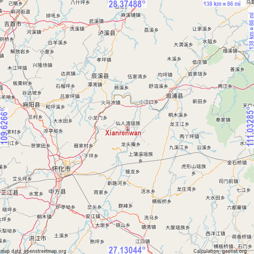
Xianrenwan GPS coordinates[2]
27° 45' 15.984" North, 110° 19' 46.992" East
| Map corner | latitude | longitude |
|---|---|---|
| Upper-left | 28.37488°, | 109.6266° |
| Center: | 27.75444°, | 110.32972° |
| Lower-right: | 27.13044°, | 111.03285° |
| Map W x H: | 138.4×138.4 km | = 86×86mi |
| max Lat: | 53.31946° ⇑75.5% North |
| Xianrenwan: | 27.75444° |
| min Lat: | ⇓24.5% South 18.22056° |
| min Long | Xianrenwan | max Long |
| 75.07348° | 110.32972° | 134.28917° |
| W 30.2%⇐ | ⇒69.8% E |
Elevation
Elevation of Xianrenwan is 151 m = 495 ft, and this is 333.8 m = 1095 ft below average elevation for this country.
| Max E: |
5622 m = 18445 ft | 51.8% |
| Avg. | 484.8 m = 1591 ft | |
| Xianrenwan | 151 m = 495 ft | |
Min E: |
-3 m = -10 ft | 48.2% |
See also: China elevation on elevation.city.
Geographical zone
Xianrenwan is located in North temperate zone (between Tropic of Cancer and the Arctic Circle). Distance of this Northern Tropic circle is 480.1 km =298.3 mi to South.| Distance of | km | miles | from Xianrenwan |
|---|---|---|---|
| North Pole | 6921.1 | 4300.6 | to North |
| Arctic Circle | 4315.2 | 2681.3 | to North |
| Tropic Cancer | 480.1 | 298.3 | to South |
| Equator | 3086 | 1917.6 | to South |


Nearby cities:
15 places around Xianrenwan: (largest is in red/bold)
• Anping
24.4 km =15.2 mi,  300°
300°
• Huangxikou
6.7 km =4.2 mi,  126°
126°
• Huaqiao
19.2 km =11.9 mi,  254°
254°
• Huomachong
17.4 km =10.8 mi,  325°
325°
• Jiuxijiang
30 km =18.6 mi,  111°
111°
• Longtou’an
9.4 km =5.8 mi,  176°
176°
• Luyang
27 km =16.8 mi,  237°
237°
• Tanwan
29.4 km =18.3 mi,  323°
323°
• Tongmuxi
28.4 km =17.6 mi,  75°
75°
• Tongwan
20 km =12.4 mi,  195°
195°
• Tongxihe
22.4 km =13.9 mi,  91°
91°
• Xiaohenglong
24.8 km =15.4 mi, 132°
• Xiaojiangkou
18.1 km =11.2 mi,  39°
39°
• Xiaolongmen
17.5 km =10.9 mi,  287°
287°
• Xiuxi
25 km =15.5 mi,  352°
352°
Sources, notices
• [Note1] Compared only with cities in China existing in our database
• [Src1] Map data: © OpenStreetMap contributors (CC-BY-SA)
• [Src2] Other city data from geonames.org with taken over terms of usage.
• [Src3] Geographical zone / Annual Mean Temperature by Robert A. Rohde @ Wikipedia
