Yuzhong Chengguanzhen geodata
Yuzhong Chengguanzhen (Gansu) is a seat of a third-order administrative division; located in China in Asia/Shanghai (GMT+8) time zone. In our database, there are 1268 cities with bigger population. Compared to other cities in China, 76.8% of cities are located further ↓South; 90.2% of cities are located further →East and 94.6% of cities have lower elevation than Yuzhong Chengguanzhen. Note1


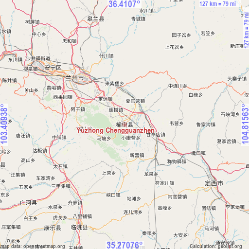
Yuzhong Chengguanzhen GPS coordinates[2]
35° 50' 34.008" North, 104° 6' 45" East
| Map corner | latitude | longitude |
|---|---|---|
| Upper-left | 36.4107°, | 103.40938° |
| Center: | 35.84278°, | 104.1125° |
| Lower-right: | 35.27076°, | 104.81563° |
| Map W x H: | 126.7×126.7 km | = 78.7×78.7mi |
| max Lat: | 53.31946° ⇑23.2% North |
| Yuzhong Chengguanzhen: | 35.84278° |
| min Lat: | ⇓76.8% South 18.22056° |
| min Long | Yuzhong Chenggu | max Long |
| 75.07348° | 104.1125° | 134.28917° |
| W 9.8%⇐ | ⇒90.2% E |
Elevation
Elevation of Yuzhong Chengguanzhen is 1981 m = 6499 ft, and this is 1496.2 m = 4909 ft above average elevation for this country.
| Max E: |
5622 m = 18445 ft | 5.4% |
| Yuzhong Chengguanzhen | 1981 m 6499 ft | |
| Avg. | 484.8 m = 1591 ft | |
Min E: |
-3 m = -10 ft | 94.6% |
See also: China elevation on elevation.city.
Geographical zone
Yuzhong Chengguanzhen is located in North temperate zone (between Tropic of Cancer and the Arctic Circle). Distance of this Northern Tropic circle is 1379.4 km =857.1 mi to South.| Distance of | km | miles | from Yuzhong Chengguanzhen |
|---|---|---|---|
| North Pole | 6021.7 | 3741.7 | to North |
| Arctic Circle | 3415.8 | 2122.5 | to North |
| Tropic Cancer | 1379.4 | 857.1 | to South |
| Equator | 3985.3 | 2476.3 | to South |


Nearby cities:
15 places around Yuzhong Chengguanzhen: (largest is in red/bold)
• Anning Xilu
45.7 km =28.4 mi,  309°
309°
• Baiyin
78.5 km =48.8 mi,  3°
3°
• Dingxi
55.1 km =34.2 mi,  123°
123°
• Fucheng
63.9 km =39.7 mi,  215°
215°
• Fulilu
53.2 km =33.1 mi,  302°
302°
• Gaolan Chengguanzhen
56.7 km =35.2 mi,  344°
344°
• Guanghe Chengguanzhen
62.9 km =39.1 mi,  230°
230°
• Lanzhou
34.2 km =21.3 mi, 314°
• Liujiaxia
72.3 km =44.9 mi,  278°
278°
• Renminlu
78.9 km =49 mi, 3°
• Suonan
67.4 km =41.9 mi,  253°
253°
• Taoyang
54.4 km =33.8 mi,  205°
205°
• Xihu
39.2 km =24.4 mi, 309°
• Zhangyelu
35.4 km =22 mi, 312°
• Zhonghualu
51.1 km =31.8 mi, 121°
Sources, notices
• [Note1] Compared only with cities in China existing in our database
• [Src1] Map data: © OpenStreetMap contributors (CC-BY-SA)
• [Src2] Other city data from geonames.org with taken over terms of usage.
• [Src3] Geographical zone / Annual Mean Temperature by Robert A. Rohde @ Wikipedia
