Tanwan geodata
Tanwan (Hunan) is a populated place; located in China in Asia/Shanghai (GMT+8) time zone. With population of 1,630 people, there are 1070 cities with bigger population in this country. Compared to other cities in China, 74.3% of cities are located further ↑North; 70.6% of cities are located further →East and 54% of cities have higher elevation than Tanwan. Note1


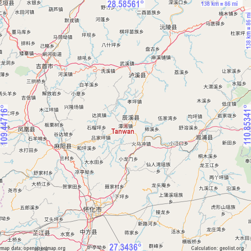
Tanwan GPS coordinates[2]
27° 57' 59.004" North, 110° 9' 1.008" East
| Map corner | latitude | longitude |
|---|---|---|
| Upper-left | 28.58561°, | 109.44716° |
| Center: | 27.96639°, | 110.15028° |
| Lower-right: | 27.3436°, | 110.85341° |
| Map W x H: | 138.1×138.1 km | = 85.8×85.8mi |
| max Lat: | 53.31946° ⇑74.3% North |
| Tanwan: | 27.96639° |
| min Lat: | ⇓25.7% South 18.22056° |
| min Long | Tanwan | max Long |
| 75.07348° | 110.15028° | 134.28917° |
| W 29.4%⇐ | ⇒70.6% E |
Elevation
Elevation of Tanwan is 137 m = 449 ft, and this is 347.8 m = 1141 ft below average elevation for this country.
| Max E: |
5622 m = 18445 ft | 54% |
| Avg. | 484.8 m = 1591 ft | |
| Tanwan | 137 m = 449 ft | |
Min E: |
-3 m = -10 ft | 46% |
See also: China elevation on elevation.city.
Geographical zone
Tanwan is located in North temperate zone (between Tropic of Cancer and the Arctic Circle). Distance of this Northern Tropic circle is 503.7 km =313 mi to South.| Distance of | km | miles | from Tanwan |
|---|---|---|---|
| North Pole | 6897.5 | 4285.9 | to North |
| Arctic Circle | 4291.6 | 2666.7 | to North |
| Tropic Cancer | 503.7 | 313 | to South |
| Equator | 3109.6 | 1932.2 | to South |


Nearby cities:
15 places around Tanwan: (largest is in red/bold)
• Anping
11.6 km =7.2 mi,  196°
196°
• Baisha
28.9 km =18 mi,  13°
13°
• Chenyang
5.9 km =3.7 mi,  22°
22°
• Chuanxi
25.3 km =15.7 mi,  25°
25°
• Heshui
21.8 km =13.5 mi,  274°
274°
• Huaqiao
28.7 km =17.8 mi,  181°
181°
• Huomachong
12.1 km =7.5 mi,  139°
139°
• Lanli
24.4 km =15.2 mi,  248°
248°
• Pushi
13.9 km =8.6 mi,  337°
337°
• Tianwan
16.4 km =10.2 mi, 30°
• Xianrenwan
29.4 km =18.3 mi, 143°
• Xiaojiangkou
30.7 km =19.1 mi,  108°
108°
• Xiaolongmen
18.3 km =11.4 mi, 176°
• Xiuxi
14.2 km =8.8 mi,  85°
85°
• Yongping
30.7 km =19.1 mi,  47°
47°
Sources, notices
• [Note1] Compared only with cities in China existing in our database
• [Src1] Map data: © OpenStreetMap contributors (CC-BY-SA)
• [Src2] Other city data from geonames.org with taken over terms of usage.
• [Src3] Geographical zone / Annual Mean Temperature by Robert A. Rohde @ Wikipedia
