Huomachong geodata
Huomachong (Hunan) is a populated place; located in China in Asia/Shanghai (GMT+8) time zone. With population of 1,930 people, there are 1040 cities with bigger population in this country. Compared to other cities in China, 74.7% of cities are located further ↑North; 70.3% of cities are located further →East and 51.6% of cities have lower elevation than Huomachong. Note1


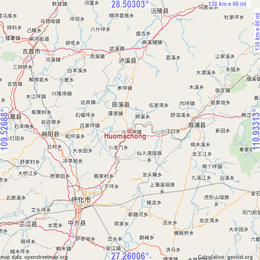
Huomachong GPS coordinates[2]
27° 52' 59.988" North, 110° 13' 48" East
| Map corner | latitude | longitude |
|---|---|---|
| Upper-left | 28.50303°, | 109.52688° |
| Center: | 27.88333°, | 110.23° |
| Lower-right: | 27.26006°, | 110.93313° |
| Map W x H: | 138.2×138.2 km | = 85.9×85.9mi |
| max Lat: | 53.31946° ⇑74.7% North |
| Huomachong: | 27.88333° |
| min Lat: | ⇓25.3% South 18.22056° |
| min Long | Huomachong | max Long |
| 75.07348° | 110.23° | 134.28917° |
| W 29.7%⇐ | ⇒70.3% E |
Elevation
Elevation of Huomachong is 178 m = 584 ft, and this is 306.8 m = 1007 ft below average elevation for this country.
| Max E: |
5622 m = 18445 ft | 48.4% |
| Avg. | 484.8 m = 1591 ft | |
| Huomachong | 178 m = 584 ft | |
Min E: |
-3 m = -10 ft | 51.6% |
See also: China elevation on elevation.city.
Geographical zone
Huomachong is located in North temperate zone (between Tropic of Cancer and the Arctic Circle). Distance of this Northern Tropic circle is 494.4 km =307.2 mi to South.| Distance of | km | miles | from Huomachong |
|---|---|---|---|
| North Pole | 6906.7 | 4291.6 | to North |
| Arctic Circle | 4300.8 | 2672.4 | to North |
| Tropic Cancer | 494.4 | 307.2 | to South |
| Equator | 3100.3 | 1926.4 | to South |


Nearby cities:
15 places around Huomachong: (largest is in red/bold)
• Anping
11.4 km =7.1 mi,  260°
260°
• Chenyang
15.8 km =9.8 mi,  339°
339°
• Heshui
31.5 km =19.6 mi,  290°
290°
• Huangxikou
23.8 km =14.8 mi,  140°
140°
• Huaqiao
21.3 km =13.2 mi,  203°
203°
• Lanli
30.6 km =19 mi,  270°
270°
• Longtou’an
25.9 km =16.1 mi,  156°
156°
• Luyang
31.6 km =19.6 mi, 204°
• Pushi
25.7 km =16 mi,  329°
329°
• Tanwan
12.1 km =7.5 mi,  319°
319°
• Tianwan
23.4 km =14.5 mi,  1°
1°
• Xianrenwan
17.4 km =10.8 mi,  145°
145°
• Xiaojiangkou
21.3 km =13.2 mi,  90°
90°
• Xiaolongmen
11.3 km =7 mi,  217°
217°
• Xiuxi
12.2 km =7.6 mi,  31°
31°
Sources, notices
• [Note1] Compared only with cities in China existing in our database
• [Src1] Map data: © OpenStreetMap contributors (CC-BY-SA)
• [Src2] Other city data from geonames.org with taken over terms of usage.
• [Src3] Geographical zone / Annual Mean Temperature by Robert A. Rohde @ Wikipedia
