Shitouzui geodata
Shitouzui (Hubei) is a seat of a fourth-order administrative division; located in China in Asia/Shanghai (GMT+8) time zone. In our database, there are 1268 cities with bigger population. Compared to other cities in China, 54.8% of cities are located further ↓South; 58.5% of cities are located further ←West and 50.3% of cities have higher elevation than Shitouzui. Note1


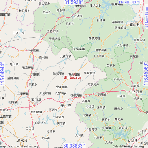
Shitouzui GPS coordinates[2]
30° 59' 34.692" North, 115° 45' 9.216" East
| Map corner | latitude | longitude |
|---|---|---|
| Upper-left | 31.5938°, | 115.04944° |
| Center: | 30.99297°, | 115.75256° |
| Lower-right: | 30.38833°, | 116.45569° |
| Map W x H: | 134×134 km | = 83.3×83.3mi |
| max Lat: | 53.31946° ⇑45.2% North |
| Shitouzui: | 30.99297° |
| min Lat: | ⇓54.8% South 18.22056° |
| min Long | Shitouzui | max Long |
| 75.07348° | 115.75256° | 134.28917° |
| W 58.5%⇐ | ⇒41.5% E |
Elevation
Elevation of Shitouzui is 162 m = 531 ft, and this is 322.8 m = 1059 ft below average elevation for this country.
| Max E: |
5622 m = 18445 ft | 50.3% |
| Avg. | 484.8 m = 1591 ft | |
| Shitouzui | 162 m = 531 ft | |
Min E: |
-3 m = -10 ft | 49.7% |
See also: China elevation on elevation.city.
Geographical zone
Shitouzui is located in North temperate zone (between Tropic of Cancer and the Arctic Circle). Distance of this Northern Tropic circle is 840.2 km =522.1 mi to South.| Distance of | km | miles | from Shitouzui |
|---|---|---|---|
| North Pole | 6561 | 4076.8 | to North |
| Arctic Circle | 3955.1 | 2457.6 | to North |
| Tropic Cancer | 840.2 | 522.1 | to South |
| Equator | 3446.1 | 2141.3 | to South |


Nearby cities:
15 places around Shitouzui: (largest is in red/bold)
• Baimiaohe
14.4 km =8.9 mi,  273°
273°
• Caodipan
14 km =8.7 mi,  84°
84°
• Dahe’an
31.3 km =19.4 mi,  237°
237°
• Fengshan
33.7 km =20.9 mi,  249°
249°
• Hepu
35.3 km =21.9 mi, 270°
• Hongshan
26.7 km =16.6 mi,  201°
201°
• Jinjiapu
15.8 km =9.8 mi,  224°
224°
• Jiuzihe
18.2 km =11.3 mi,  334°
334°
• Kongjiafang
20.8 km =12.9 mi,  214°
214°
• Kuanghe
37.2 km =23.1 mi, 210°
• Leijiadian
11.8 km =7.3 mi,  180°
180°
• Shengli
31.7 km =19.7 mi,  299°
299°
• Taojiahe
19.6 km =12.2 mi,  117°
117°
• Wenquan
16.8 km =10.4 mi, 197°
• Yangliuwan
19.1 km =11.9 mi,  174°
174°
Sources, notices
• [Note1] Compared only with cities in China existing in our database
• [Src1] Map data: © OpenStreetMap contributors (CC-BY-SA)
• [Src2] Other city data from geonames.org with taken over terms of usage.
• [Src3] Geographical zone / Annual Mean Temperature by Robert A. Rohde @ Wikipedia
