Shawo geodata
Shawo (Hebei) is a seat of a fourth-order administrative division; located in China in Asia/Shanghai (GMT+8) time zone. In our database, there are 1268 cities with bigger population. Compared to other cities in China, 82.7% of cities are located further ↓South; 51.1% of cities are located further →East and 72.3% of cities have lower elevation than Shawo. Note1


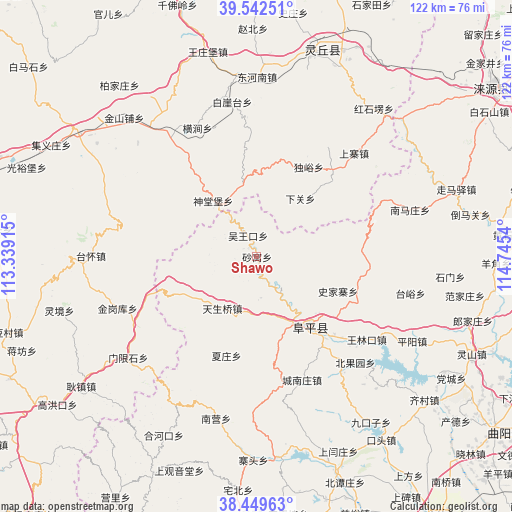
Shawo GPS coordinates[2]
38° 59' 53.448" North, 114° 2' 32.172" East
| Map corner | latitude | longitude |
|---|---|---|
| Upper-left | 39.54251°, | 113.33915° |
| Center: | 38.99818°, | 114.04227° |
| Lower-right: | 38.44963°, | 114.7454° |
| Map W x H: | 121.5×121.5 km | = 75.5×75.5mi |
| max Lat: | 53.31946° ⇑17.3% North |
| Shawo: | 38.99818° |
| min Lat: | ⇓82.7% South 18.22056° |
| min Long | Shawo | max Long |
| 75.07348° | 114.04227° | 134.28917° |
| W 48.9%⇐ | ⇒51.1% E |
Elevation
Elevation of Shawo is 460 m = 1509 ft, and this is 24.8 m = 81 ft below average elevation for this country.
| Max E: |
5622 m = 18445 ft | 27.7% |
| Avg. | 484.8 m = 1591 ft | |
| Shawo | 460 m = 1509 ft | |
Min E: |
-3 m = -10 ft | 72.3% |
See also: China elevation on elevation.city.
Geographical zone
Shawo is located in North temperate zone (between Tropic of Cancer and the Arctic Circle). Distance of this Northern Tropic circle is 1730.3 km =1075.2 mi to South.| Distance of | km | miles | from Shawo |
|---|---|---|---|
| North Pole | 5670.9 | 3523.7 | to North |
| Arctic Circle | 3065 | 1904.5 | to North |
| Tropic Cancer | 1730.3 | 1075.2 | to South |
| Equator | 4336.2 | 2694.4 | to South |


Nearby cities:
15 places around Shawo: (largest is in red/bold)
• Baiyatai
37.2 km =23.1 mi,  350°
350°
• Beiguoyuan
34.4 km =21.4 mi,  136°
136°
• Chengnanzhuang
31.3 km =19.4 mi,  159°
159°
• Datai
28.6 km =17.8 mi,  93°
93°
• Daying
40.7 km =25.3 mi,  322°
322°
• Donghenan
42.7 km =26.5 mi,  0°
0°
• Hengjian
33.6 km =20.9 mi,  335°
335°
• Jinshanpu
45.5 km =28.3 mi, 316°
• Pingyang
42.1 km =26.2 mi,  118°
118°
• Shentangbao
16.8 km =10.4 mi, 322°
• Shijiazhai
21 km =13 mi,  112°
112°
• Taiyu
37.7 km =23.4 mi,  103°
103°
• Wanglinkou
32.5 km =20.2 mi,  127°
127°
• Wuwangkou
5.6 km =3.5 mi, 338°
• Yanglinjie
39 km =24.2 mi,  271°
271°
Sources, notices
• [Note1] Compared only with cities in China existing in our database
• [Src1] Map data: © OpenStreetMap contributors (CC-BY-SA)
• [Src2] Other city data from geonames.org with taken over terms of usage.
• [Src3] Geographical zone / Annual Mean Temperature by Robert A. Rohde @ Wikipedia
