Datai geodata
Datai (Hebei) is a seat of a fourth-order administrative division; located in China in Asia/Shanghai (GMT+8) time zone. In our database, there are 1268 cities with bigger population. Compared to other cities in China, 82.7% of cities are located further ↓South; 50.8% of cities are located further ←West and 73.9% of cities have lower elevation than Datai. Note1


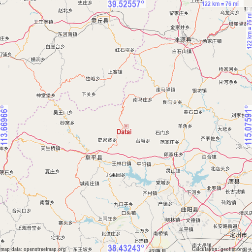
Datai GPS coordinates[2]
38° 58' 51.996" North, 114° 22' 22.008" East
| Map corner | latitude | longitude |
|---|---|---|
| Upper-left | 39.52557°, | 113.66966° |
| Center: | 38.98111°, | 114.37278° |
| Lower-right: | 38.43243°, | 115.07591° |
| Map W x H: | 121.5×121.5 km | = 75.5×75.5mi |
| max Lat: | 53.31946° ⇑17.3% North |
| Datai: | 38.98111° |
| min Lat: | ⇓82.7% South 18.22056° |
| min Long | Datai | max Long |
| 75.07348° | 114.37278° | 134.28917° |
| W 50.8%⇐ | ⇒49.2% E |
Elevation
Elevation of Datai is 499 m = 1637 ft, and this is 14.2 m = 47 ft above average elevation for this country.
| Max E: |
5622 m = 18445 ft | 26.1% |
| Datai | 499 m 1637 ft | |
| Avg. | 484.8 m = 1591 ft | |
Min E: |
-3 m = -10 ft | 73.9% |
See also: China elevation on elevation.city.
Geographical zone
Datai is located in North temperate zone (between Tropic of Cancer and the Arctic Circle). Distance of this Northern Tropic circle is 1728.4 km =1074 mi to South.| Distance of | km | miles | from Datai |
|---|---|---|---|
| North Pole | 5672.8 | 3524.9 | to North |
| Arctic Circle | 3066.9 | 1905.7 | to North |
| Tropic Cancer | 1728.4 | 1074 | to South |
| Equator | 4334.3 | 2693.2 | to South |


Nearby cities:
15 places around Datai: (largest is in red/bold)
• Beiguoyuan
23.5 km =14.6 mi,  191°
191°
• Beitai
21.1 km =13.1 mi,  133°
133°
• Dangcheng
32.2 km =20 mi,  147°
147°
• Fanjiazhuang
21.9 km =13.6 mi,  109°
109°
• Juncheng
28.6 km =17.8 mi,  100°
100°
• Langjiazhuang
26.4 km =16.4 mi,  119°
119°
• Lingshan
31.1 km =19.3 mi, 133°
• Pingyang
20.1 km =12.5 mi,  155°
155°
• Shawo
28.6 km =17.8 mi,  273°
273°
• Shijiazhai
11.2 km =7 mi,  235°
235°
• Shimen
17.6 km =10.9 mi, 99°
• Taiyu
10.5 km =6.5 mi, 129°
• Wanglinkou
17.9 km =11.1 mi, 188°
• Wuwangkou
31.4 km =19.5 mi,  283°
283°
• Yangjiao
27.9 km =17.3 mi,  89°
89°
Sources, notices
• [Note1] Compared only with cities in China existing in our database
• [Src1] Map data: © OpenStreetMap contributors (CC-BY-SA)
• [Src2] Other city data from geonames.org with taken over terms of usage.
• [Src3] Geographical zone / Annual Mean Temperature by Robert A. Rohde @ Wikipedia
