Shaping geodata
Shaping (Sichuan) is a seat of a third-order administrative division; located in China in Asia/Shanghai (GMT+8) time zone. In our database, there are 1268 cities with bigger population. Compared to other cities in China, 62.9% of cities are located further ↑North; 91.2% of cities are located further →East and 79.7% of cities have lower elevation than Shaping. Note1


Shaping GPS coordinates[2]
29° 13' 50.952" North, 103° 15' 57.132" East
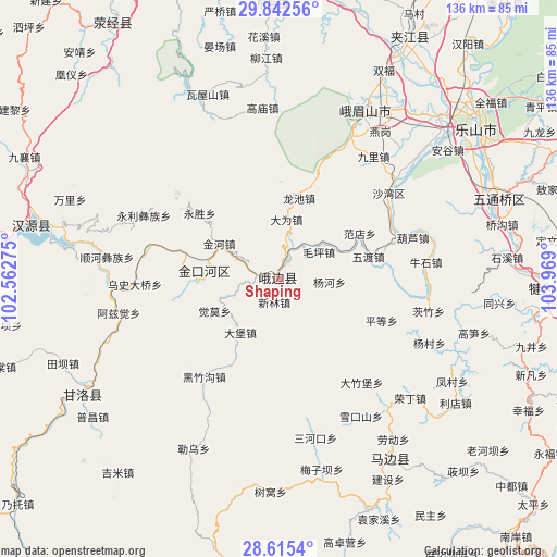
| Map corner | latitude | longitude |
|---|---|---|
| Upper-left | 29.84256°, | 102.56275° |
| Center: | 29.23082°, | 103.26587° |
| Lower-right: | 28.6154°, | 103.969° |
| Map W x H: | 136.4×136.4 km | = 84.8×84.8mi |
| max Lat: | 53.31946° ⇑62.9% North |
| Shaping: | 29.23082° |
| min Lat: | ⇓37.1% South 18.22056° |
| min Long | Shaping | max Long |
| 75.07348° | 103.26587° | 134.28917° |
| W 8.8%⇐ | ⇒91.2% E |
Elevation
Elevation of Shaping is 683 m = 2241 ft, and this is 198.2 m = 650 ft above average elevation for this country.
| Max E: |
5622 m = 18445 ft | 20.3% |
| Shaping | 683 m 2241 ft | |
| Avg. | 484.8 m = 1591 ft | |
Min E: |
-3 m = -10 ft | 79.7% |
See also: China elevation on elevation.city.
Geographical zone
Shaping is located in North temperate zone (between Tropic of Cancer and the Arctic Circle). Distance of this Northern Tropic circle is 644.2 km =400.3 mi to South.| Distance of | km | miles | from Shaping |
|---|---|---|---|
| North Pole | 6756.9 | 4198.5 | to North |
| Arctic Circle | 4151 | 2579.3 | to North |
| Tropic Cancer | 644.2 | 400.3 | to South |
| Equator | 3250.2 | 2019.6 | to South |


Nearby cities:
15 places around Shaping: (largest is in red/bold)
• Hepingyizu
17.9 km =11.1 mi,  275°
275°
• Leshan
60.7 km =37.7 mi,  52°
52°
• Luocheng
75.9 km =47.2 mi,  76°
76°
• Minjian
50.7 km =31.5 mi,  147°
147°
• Muxi
68.7 km =42.7 mi,  116°
116°
• Nan’an
65.3 km =40.6 mi,  19°
19°
• Shawan
33.5 km =20.8 mi, 53°
• Shirong
61 km =37.9 mi, 282°
• Suishan
47.1 km =29.3 mi,  26°
26°
• Xinmian
86.7 km =53.9 mi,  270°
270°
• Xinshiba
56.1 km =34.9 mi,  238°
238°
• Yancheng
64 km =39.8 mi, 27°
• Yancheng
90.6 km =56.3 mi,  58°
58°
• Yucheng
87.8 km =54.6 mi,  342°
342°
• Yujin
66 km =41 mi,  92°
92°
Sources, notices
• [Note1] Compared only with cities in China existing in our database
• [Src1] Map data: © OpenStreetMap contributors (CC-BY-SA)
• [Src2] Other city data from geonames.org with taken over terms of usage.
• [Src3] Geographical zone / Annual Mean Temperature by Robert A. Rohde @ Wikipedia
