Yucheng geodata
Yucheng (Sichuan) is a seat of a second-order administrative division; located in China in Asia/Shanghai (GMT+8) time zone. In our database, there are 1268 cities with bigger population. Compared to other cities in China, 54.2% of cities are located further ↑North; 91.5% of cities are located further →East and 77.5% of cities have lower elevation than Yucheng. Note1


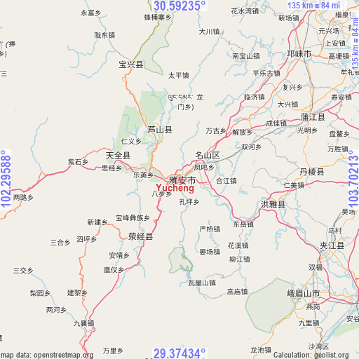
Yucheng GPS coordinates[2]
29° 59' 6.756" North, 102° 59' 56.4" East
| Map corner | latitude | longitude |
|---|---|---|
| Upper-left | 30.59235°, | 102.29588° |
| Center: | 29.98521°, | 102.999° |
| Lower-right: | 29.37434°, | 103.70213° |
| Map W x H: | 135.4×135.4 km | = 84.1×84.1mi |
| max Lat: | 53.31946° ⇑54.2% North |
| Yucheng: | 29.98521° |
| min Lat: | ⇓45.8% South 18.22056° |
| min Long | Yucheng | max Long |
| 75.07348° | 102.999° | 134.28917° |
| W 8.5%⇐ | ⇒91.5% E |
Elevation
Elevation of Yucheng is 591 m = 1939 ft, and this is 106.2 m = 348 ft above average elevation for this country.
| Max E: |
5622 m = 18445 ft | 22.5% |
| Yucheng | 591 m 1939 ft | |
| Avg. | 484.8 m = 1591 ft | |
Min E: |
-3 m = -10 ft | 77.5% |
See also: China elevation on elevation.city.
Geographical zone
Yucheng is located in North temperate zone (between Tropic of Cancer and the Arctic Circle). Distance of this Northern Tropic circle is 728.1 km =452.4 mi to South.| Distance of | km | miles | from Yucheng |
|---|---|---|---|
| North Pole | 6673 | 4146.4 | to North |
| Arctic Circle | 4067.1 | 2527.2 | to North |
| Tropic Cancer | 728.1 | 452.4 | to South |
| Equator | 3334 | 2071.7 | to South |


Nearby cities:
15 places around Yucheng: (largest is in red/bold)
• Guangsheng
105.5 km =65.6 mi,  37°
37°
• Hepingyizu
82.5 km =51.3 mi,  174°
174°
• Kangding
100.4 km =62.4 mi,  271°
271°
• Leshan
87.5 km =54.4 mi,  122°
122°
• Linqiong
65.3 km =40.6 mi, 42°
• Luqiao
74.2 km =46.1 mi, 265°
• Muping
46.4 km =28.8 mi,  337°
337°
• Nan’an
52.7 km =32.7 mi, 115°
• Shaping
87.8 km =54.6 mi,  162°
162°
• Shawan
82.7 km =51.4 mi,  140°
140°
• Shirong
78.1 km =48.5 mi,  205°
205°
• Suishan
63 km =39.1 mi,  131°
131°
• Wujin
91.5 km =56.9 mi,  58°
58°
• Xinmian
102.7 km =63.8 mi,  216°
216°
• Yancheng
61 km =37.9 mi, 116°
Sources, notices
• [Note1] Compared only with cities in China existing in our database
• [Src1] Map data: © OpenStreetMap contributors (CC-BY-SA)
• [Src2] Other city data from geonames.org with taken over terms of usage.
• [Src3] Geographical zone / Annual Mean Temperature by Robert A. Rohde @ Wikipedia
