Shangyi geodata
Shangyi (Guangdong) is a seat of a fourth-order administrative division; located in China in Asia/Shanghai (GMT+8) time zone. In our database, there are 1268 cities with bigger population. Compared to other cities in China, 93.1% of cities are located further ↑North; 53.2% of cities are located further ←West and 62.9% of cities have higher elevation than Shangyi. Note1


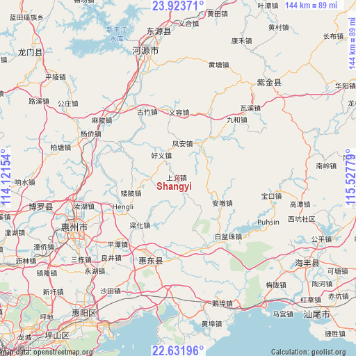
Shangyi GPS coordinates[2]
23° 16' 45.84" North, 114° 49' 28.776" East
| Map corner | latitude | longitude |
|---|---|---|
| Upper-left | 23.92371°, | 114.12154° |
| Center: | 23.2794°, | 114.82466° |
| Lower-right: | 22.63196°, | 115.52779° |
| Map W x H: | 143.6×143.6 km | = 89.2×89.2mi |
| max Lat: | 53.31946° ⇑93.1% North |
| Shangyi: | 23.2794° |
| min Lat: | ⇓6.9% South 18.22056° |
| min Long | Shangyi | max Long |
| 75.07348° | 114.82466° | 134.28917° |
| W 53.2%⇐ | ⇒46.8% E |
Elevation
Elevation of Shangyi is 83 m = 272 ft, and this is 401.8 m = 1318 ft below average elevation for this country.
| Max E: |
5622 m = 18445 ft | 62.9% |
| Avg. | 484.8 m = 1591 ft | |
| Shangyi | 83 m = 272 ft | |
Min E: |
-3 m = -10 ft | 37.1% |
See also: China elevation on elevation.city.
Geographical zone
Shangyi is located in North Torrid zone (between Equator and Tropic of Cancer). Distance of this Northern Tropic circle is 17.5 km =10.9 mi to North.| Distance of | km | miles | from Shangyi |
|---|---|---|---|
| North Pole | 7418.6 | 4609.7 | to North |
| Arctic Circle | 4812.7 | 2990.5 | to North |
| Tropic Cancer | 17.5 | 10.9 | to North |
| Equator | 2588.4 | 1608.4 | to South |


Nearby cities:
15 places around Shangyi: (largest is in red/bold)
• Aipi
19.9 km =12.4 mi,  253°
253°
• Andun
21.3 km =13.2 mi,  120°
120°
• Baipenzhu
30.7 km =19.1 mi,  138°
138°
• Dalan
11.1 km =6.9 mi,  271°
271°
• Duozhu
30.5 km =19 mi,  155°
155°
• Feng’an
14.8 km =9.2 mi,  8°
8°
• Guanyinge
28.5 km =17.7 mi,  297°
297°
• Guzhu
28.9 km =18 mi,  335°
335°
• Haoyi
12.4 km =7.7 mi,  324°
324°
• Hengli
24.1 km =15 mi,  240°
240°
• Lantang
18.6 km =11.6 mi,  36°
36°
• Lianghua
23.4 km =14.5 mi,  219°
219°
• Songkeng
14.1 km =8.8 mi, 139°
• Yirong
27.1 km =16.8 mi,  1°
1°
• Zengguang
29.5 km =18.3 mi,  170°
170°
Sources, notices
• [Note1] Compared only with cities in China existing in our database
• [Src1] Map data: © OpenStreetMap contributors (CC-BY-SA)
• [Src2] Other city data from geonames.org with taken over terms of usage.
• [Src3] Geographical zone / Annual Mean Temperature by Robert A. Rohde @ Wikipedia
