Shaliuhe geodata
Shaliuhe (Qinghai) is a seat of a third-order administrative division; located in China in Asia/Shanghai (GMT+8) time zone. In our database, there are 1268 cities with bigger population. Compared to other cities in China, 79.8% of cities are located further ↓South; 94.5% of cities are located further →East and 97.4% of cities have lower elevation than Shaliuhe. Note1


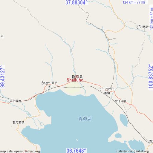
Shaliuhe GPS coordinates[2]
37° 19' 33.6" North, 100° 8' 3.804" East
| Map corner | latitude | longitude |
|---|---|---|
| Upper-left | 37.88304°, | 99.43127° |
| Center: | 37.326°, | 100.13439° |
| Lower-right: | 36.7648°, | 100.83752° |
| Map W x H: | 124.3×124.3 km | = 77.2×77.2mi |
| max Lat: | 53.31946° ⇑20.2% North |
| Shaliuhe: | 37.326° |
| min Lat: | ⇓79.8% South 18.22056° |
| min Long | Shaliuhe | max Long |
| 75.07348° | 100.13439° | 134.28917° |
| W 5.5%⇐ | ⇒94.5% E |
Elevation
Elevation of Shaliuhe is 3302 m = 10833 ft, and this is 2817.2 m = 9243 ft above average elevation for this country.
| Max E: |
5622 m = 18445 ft | 2.6% |
| Shaliuhe | 3302 m 10833 ft | |
| Avg. | 484.8 m = 1591 ft | |
Min E: |
-3 m = -10 ft | 97.4% |
See also: China elevation on elevation.city.
Geographical zone
Shaliuhe is located in North temperate zone (between Tropic of Cancer and the Arctic Circle). Distance of this Northern Tropic circle is 1544.3 km =959.6 mi to South.| Distance of | km | miles | from Shaliuhe |
|---|---|---|---|
| North Pole | 5856.8 | 3639.2 | to North |
| Arctic Circle | 3250.9 | 2020 | to North |
| Tropic Cancer | 1544.3 | 959.6 | to South |
| Equator | 4150.3 | 2578.9 | to South |


Nearby cities:
15 places around Shaliuhe: (largest is in red/bold)
• Hairag
27.4 km =17 mi,  114°
114°
• Heimahe
73.6 km =45.7 mi,  205°
205°
• Huangcheng
99.2 km =61.6 mi,  71°
71°
• Jiangxigou
77.9 km =48.4 mi,  171°
171°
• Jirmeng
53.6 km =33.3 mi,  248°
248°
• Muri
66 km =41 mi,  52°
52°
• Qiecha
60.1 km =37.3 mi,  232°
232°
• Qilian
95.5 km =59.3 mi,  5°
5°
• Qinghaihu
81.5 km =50.6 mi,  131°
131°
• Sanjiaocheng
90.7 km =56.4 mi,  122°
122°
• Shinaihai
58.9 km =36.6 mi, 229°
• Sujitan
96.5 km =60 mi,  77°
77°
• Tuohua
55.7 km =34.6 mi, 119°
• Zamashi
98.2 km =61 mi,  353°
353°
• Zhugkyung
70.4 km =43.7 mi,  295°
295°
Sources, notices
• [Note1] Compared only with cities in China existing in our database
• [Src1] Map data: © OpenStreetMap contributors (CC-BY-SA)
• [Src2] Other city data from geonames.org with taken over terms of usage.
• [Src3] Geographical zone / Annual Mean Temperature by Robert A. Rohde @ Wikipedia
